San Martín Comalapa geodata
San Martín Comalapa (Puebla) is a populated place; located in Mexico in America/Mexico_City (GMT-6) time zone. With population of 741 people, there are 11804 cities with bigger population in this country. Compared to other cities in Mexico, 59.4% of cities are located further ↑North; 74.8% of cities are located further ←West and 53.9% of cities have higher elevation than San Martín Comalapa. Note1


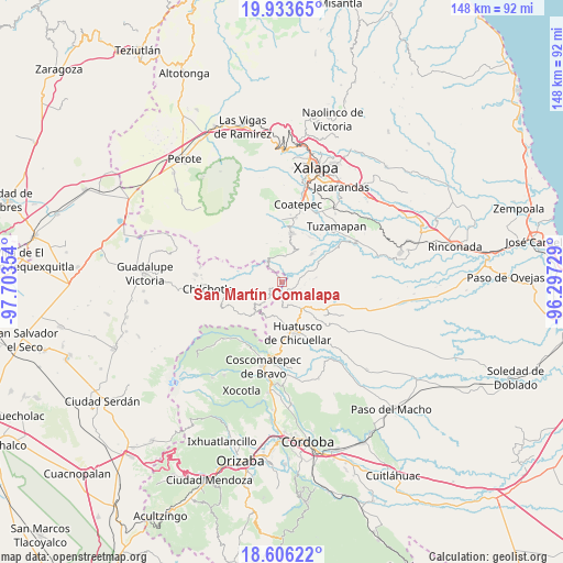
San Martín Comalapa GPS coordinates[2]
19° 16' 16.608" North, 97° 0' 1.476" West
| Map corner | latitude | longitude |
|---|---|---|
| Upper-left | 19.93365°, | -97.70354° |
| Center: | 19.27128°, | -97.00041° |
| Lower-right: | 18.60622°, | -96.29729° |
| Map W x H: | 147.6×147.6 km | = 91.7×91.7mi |
| max Lat: | 32.7° ⇑59.4% North |
| San Martín Comalapa: | 19.27128° |
| min Lat: | ⇓40.6% South 14.53588° |
| min Long | San Martín Com | max Long |
| -117.105° | -97.00041° | -86.73105° |
| W 74.8%⇐ | ⇒25.2% E |
Elevation
Elevation of San Martín Comalapa is 1249 m = 4098 ft, and this is 4.7 m = 15 ft below average elevation for this country.
| Max E: |
3497 m = 11473 ft | 53.9% |
| Avg. | 1253.7 m = 4113 ft | |
| San Martín Comalapa | 1249 m = 4098 ft | |
Min E: |
-1 m = -3 ft | 46.1% |
See also: Mexico elevation on elevation.city.
Geographical zone
San Martín Comalapa is located in North Torrid zone (between Equator and Tropic of Cancer). Distance of this Northern Tropic circle is 463.2 km =287.8 mi to North.| Distance of | km | miles | from San Martín Comalapa |
|---|---|---|---|
| North Pole | 7864.3 | 4886.6 | to North |
| Arctic Circle | 5258.4 | 3267.4 | to North |
| Tropic Cancer | 463.2 | 287.8 | to North |
| Equator | 2142.8 | 1331.5 | to South |


Nearby cities:
15 places around San Martín Comalapa: (largest is in red/bold)
• Barranca Nueva
8.4 km =5.2 mi,  331°
331°
• Buenavista
8 km =5 mi,  259°
259°
• Casa Quemada
6.9 km =4.3 mi,  345°
345°
• Cinco de Mayo
8.5 km =5.3 mi,  247°
247°
• Cosautlán
6.8 km =4.2 mi,  8°
8°
• El Triunfo
5.8 km =3.6 mi,  221°
221°
• Emiliano Zapata
4 km =2.5 mi,  38°
38°
• Huehuetecpan
5.4 km =3.4 mi,  359°
359°
• Ohuapan
2.7 km =1.7 mi,  148°
148°
• Pinillo
6.9 km =4.3 mi,  68°
68°
• San Isidro Reynosa
7.4 km =4.6 mi, 258°
• San Miguel Tlapéxcatl
3.8 km =2.4 mi, 13°
• Totutla
7.8 km =4.8 mi, 148°
• Vaquería
6.9 km =4.3 mi, 42°
• Zapotitla
7.2 km =4.5 mi,  125°
125°
Sources, notices
• [Note1] Compared only with cities in Mexico existing in our database
• [Src1] Map data: © OpenStreetMap contributors (CC-BY-SA)
• [Src2] Other city data from geonames.org with taken over terms of usage.
• [Src3] Geographical zone / Annual Mean Temperature by Robert A. Rohde @ Wikipedia
