Tlapanaloya geodata
Tlapanaloya (Morelos) is a populated place; located in Mexico in America/Mexico_City (GMT-6) time zone. With population of 6,466 people, there are 1449 cities with bigger population in this country. Compared to other cities in Mexico, 55.7% of cities are located further ↓South; 51.1% of cities are located further →East and 86% of cities have lower elevation than Tlapanaloya. Note1


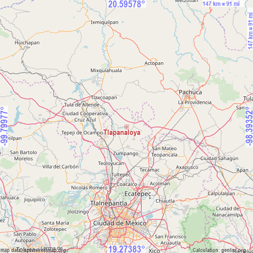
Tlapanaloya GPS coordinates[2]
19° 56' 10.284" North, 99° 5' 47.904" West
| Map corner | latitude | longitude |
|---|---|---|
| Upper-left | 20.59578°, | -99.79977° |
| Center: | 19.93619°, | -99.09664° |
| Lower-right: | 19.27383°, | -98.39352° |
| Map W x H: | 147×147 km | = 91.3×91.3mi |
| max Lat: | 32.7° ⇑44.3% North |
| Tlapanaloya: | 19.93619° |
| min Lat: | ⇓55.7% South 14.53588° |
| min Long | Tlapanaloya | max Long |
| -117.105° | -99.09664° | -86.73105° |
| W 48.9%⇐ | ⇒51.1% E |
Elevation
Elevation of Tlapanaloya is 2282 m = 7487 ft, and this is 1028.3 m = 3374 ft above average elevation for this country.
| Max E: |
3497 m = 11473 ft | 14% |
| Tlapanaloya | 2282 m 7487 ft | |
| Avg. | 1253.7 m = 4113 ft | |
Min E: |
-1 m = -3 ft | 86% |
See also: Mexico elevation on elevation.city.
Geographical zone
Tlapanaloya is located in North Torrid zone (between Equator and Tropic of Cancer). Distance of this Northern Tropic circle is 389.2 km =241.8 mi to North.| Distance of | km | miles | from Tlapanaloya |
|---|---|---|---|
| North Pole | 7790.4 | 4840.7 | to North |
| Arctic Circle | 5184.5 | 3221.5 | to North |
| Tropic Cancer | 389.2 | 241.8 | to North |
| Equator | 2216.7 | 1377.4 | to South |


Nearby cities:
15 places around Tlapanaloya: (largest is in red/bold)
• Apaxco de Ocampo
8.9 km =5.5 mi,  299°
299°
• Barrio de España
8.5 km =5.3 mi,  169°
169°
• Barrio el Rincón
7.1 km =4.4 mi, 166°
• Colonia 3 de Mayo (La Cruz)
8.6 km =5.3 mi,  305°
305°
• Colonia Guadalupe los Manantiales
6.5 km =4 mi,  37°
37°
• Colonia Juárez
8.6 km =5.3 mi,  320°
320°
• Hueypoxtla
3.5 km =2.2 mi,  137°
137°
• Jilotzingo
8.3 km =5.2 mi,  154°
154°
• Loma Larga (Barrio de Loma Larga)
7.9 km =4.9 mi,  194°
194°
• Oriental de Zapata
8.7 km =5.4 mi,  51°
51°
• Pérez de Galeana
6.7 km =4.2 mi, 315°
• San Miguel
8.5 km =5.3 mi,  207°
207°
• Santa María Ajoloapan
7.1 km =4.4 mi, 50°
• Santa María Cuevas
7.8 km =4.8 mi,  181°
181°
• Tequixquiac
5.8 km =3.6 mi,  239°
239°
Sources, notices
• [Note1] Compared only with cities in Mexico existing in our database
• [Src1] Map data: © OpenStreetMap contributors (CC-BY-SA)
• [Src2] Other city data from geonames.org with taken over terms of usage.
• [Src3] Geographical zone / Annual Mean Temperature by Robert A. Rohde @ Wikipedia
