San Miguel geodata
San Miguel (Morelos) is a populated place; located in Mexico in America/Mexico_City (GMT-6) time zone. With population of 2,754 people, there are 3213 cities with bigger population in this country. Compared to other cities in Mexico, 54.4% of cities are located further ↓South; 51.6% of cities are located further →East and 88% of cities have lower elevation than San Miguel. Note1


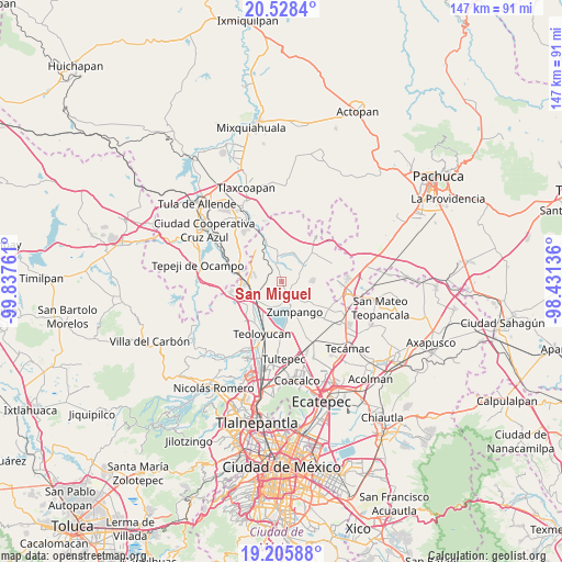
San Miguel GPS coordinates[2]
19° 52' 6.672" North, 99° 8' 4.128" West
| Map corner | latitude | longitude |
|---|---|---|
| Upper-left | 20.5284°, | -99.83761° |
| Center: | 19.86852°, | -99.13448° |
| Lower-right: | 19.20588°, | -98.43136° |
| Map W x H: | 147.1×147.1 km | = 91.4×91.4mi |
| max Lat: | 32.7° ⇑45.6% North |
| San Miguel: | 19.86852° |
| min Lat: | ⇓54.4% South 14.53588° |
| min Long | San Miguel | max Long |
| -117.105° | -99.13448° | -86.73105° |
| W 48.4%⇐ | ⇒51.6% E |
Elevation
Elevation of San Miguel is 2342 m = 7684 ft, and this is 1088.3 m = 3571 ft above average elevation for this country.
| Max E: |
3497 m = 11473 ft | 12% |
| San Miguel | 2342 m 7684 ft | |
| Avg. | 1253.7 m = 4113 ft | |
Min E: |
-1 m = -3 ft | 88% |
See also: Mexico elevation on elevation.city.
Geographical zone
San Miguel is located in North Torrid zone (between Equator and Tropic of Cancer). Distance of this Northern Tropic circle is 396.7 km =246.5 mi to North.| Distance of | km | miles | from San Miguel |
|---|---|---|---|
| North Pole | 7797.9 | 4845.4 | to North |
| Arctic Circle | 5192 | 3226.2 | to North |
| Tropic Cancer | 396.7 | 246.5 | to North |
| Equator | 2209.2 | 1372.7 | to South |


Nearby cities:
15 places around San Miguel: (largest is in red/bold)
• Barrio de España
5.6 km =3.5 mi,  98°
98°
• Barrio el Rincón
5.6 km =3.5 mi,  84°
84°
• Colonia Wenceslao Labra
4.7 km =2.9 mi,  166°
166°
• Ex-hacienda de Xalpa
7.3 km =4.5 mi,  223°
223°
• Fraccionamiento la Trinidad
7 km =4.3 mi,  128°
128°
• Loma Larga (Barrio de Loma Larga)
1.9 km =1.2 mi,  94°
94°
• Miguel Bocanegra
3.5 km =2.2 mi,  137°
137°
• San Juan Zitlaltepec
6.4 km =4 mi,  190°
190°
• San Miguel Bocanegra
3.6 km =2.2 mi, 139°
• San Pedro Xalpa
7 km =4.3 mi,  228°
228°
• Santa María Cuevas
3.7 km =2.3 mi, 94°
• Santa María I y II
6.4 km =4 mi, 141°
• Santa María de Guadalupe
5.3 km =3.3 mi, 172°
• Tequixquiac
4.7 km =2.9 mi,  346°
346°
• Villas de la Laguna
5.9 km =3.7 mi, 127°
Sources, notices
• [Note1] Compared only with cities in Mexico existing in our database
• [Src1] Map data: © OpenStreetMap contributors (CC-BY-SA)
• [Src2] Other city data from geonames.org with taken over terms of usage.
• [Src3] Geographical zone / Annual Mean Temperature by Robert A. Rohde @ Wikipedia
