San Nicolás Tenexcalco geodata
San Nicolás Tenexcalco (Puebla) is a populated place; located in Mexico in America/Mexico_City (GMT-6) time zone. With population of 792 people, there are 11019 cities with bigger population in this country. Compared to other cities in Mexico, 72.9% of cities are located further ↑North; 56.1% of cities are located further ←West and 58.1% of cities have higher elevation than San Nicolás Tenexcalco. Note1
Current local time in San Nicolás Tenexcalco:
08:33 AM, WednesdayDifference from your time zone: hours


San Nicolás Tenexcalco GPS coordinates[2]
18° 28' 52.5" North, 98° 35' 46.716" West
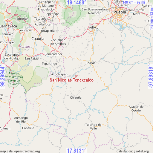
| Map corner | latitude | longitude |
|---|---|---|
| Upper-left | 19.1468°, | -99.29944° |
| Center: | 18.48125°, | -98.59631° |
| Lower-right: | 17.8131°, | -97.89319° |
| Map W x H: | 148.3×148.3 km | = 92.1×92.1mi |
| max Lat: | 32.7° ⇑72.9% North |
| San Nicolás Tenexcalco: | 18.48125° |
| min Lat: | ⇓27.1% South 14.53588° |
| min Long | San Nicolás Te | max Long |
| -117.105° | -98.59631° | -86.73105° |
| W 56.1%⇐ | ⇒43.9% E |
Elevation
Elevation of San Nicolás Tenexcalco is 1101 m = 3612 ft, and this is 152.7 m = 501 ft below average elevation for this country.
| Max E: |
3497 m = 11473 ft | 58.1% |
| Avg. | 1253.7 m = 4113 ft | |
| San Nicolás Tenexcalco | 1101 m = 3612 ft | |
Min E: |
-1 m = -3 ft | 41.9% |
See also: Mexico elevation on elevation.city.
Geographical zone
San Nicolás Tenexcalco is located in North Torrid zone (between Equator and Tropic of Cancer). Distance of this Northern Tropic circle is 551 km =342.4 mi to North.| Distance of | km | miles | from San Nicolás Tenexcalco |
|---|---|---|---|
| North Pole | 7952.1 | 4941.2 | to North |
| Arctic Circle | 5346.3 | 3322 | to North |
| Tropic Cancer | 551 | 342.4 | to North |
| Equator | 2054.9 | 1276.9 | to South |


Nearby cities:
15 places around San Nicolás Tenexcalco: (largest is in red/bold)
• Ahuehuetzingo
4.2 km =2.6 mi,  278°
278°
• Atencingo
3.7 km =2.3 mi,  344°
344°
• Atzala
8.6 km =5.3 mi,  32°
32°
• Buenavista de Benito Juárez
4.9 km =3 mi,  241°
241°
• Chietla
4.7 km =2.9 mi,  22°
22°
• Don Roque
3.3 km =2.1 mi,  265°
265°
• Lagunillas de Rayón (Alchichica)
10.7 km =6.6 mi, 272°
• Pueblo Nuevo de Porfirio Díaz
5.5 km =3.4 mi,  50°
50°
• San Carlos
9 km =5.6 mi,  66°
66°
• San Isidro el Organal
6.8 km =4.2 mi, 335°
• San Juan Colón
11.4 km =7.1 mi, 20°
• San Miguel Tecolacio
8.7 km =5.4 mi, 239°
• San Miguel la Toma
5.4 km =3.4 mi, 23°
• Temaxcalapa de Gabino Barreda
8.2 km =5.1 mi,  352°
352°
• Viborillas de Hidalgo
2.6 km =1.6 mi,  60°
60°
Sources, notices
• [Note1] Compared only with cities in Mexico existing in our database
• [Src1] Map data: © OpenStreetMap contributors (CC-BY-SA)
• [Src2] Other city data from geonames.org with taken over terms of usage.
• [Src3] Geographical zone / Annual Mean Temperature by Robert A. Rohde @ Wikipedia
