Ahuehuetzingo geodata
Ahuehuetzingo (Michoacán) is a populated place; located in Mexico in America/Mexico_City (GMT-6) time zone. With population of 960 people, there are 9064 cities with bigger population in this country. Compared to other cities in Mexico, 72.8% of cities are located further ↑North; 55.8% of cities are located further ←West and 58.8% of cities have higher elevation than Ahuehuetzingo. Note1


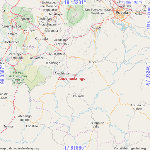
Ahuehuetzingo GPS coordinates[2]
18° 29' 12.408" North, 98° 38' 8.052" West
| Map corner | latitude | longitude |
|---|---|---|
| Upper-left | 19.15231°, | -99.3387° |
| Center: | 18.48678°, | -98.63557° |
| Lower-right: | 17.81865°, | -97.93245° |
| Map W x H: | 148.3×148.3 km | = 92.1×92.1mi |
| max Lat: | 32.7° ⇑72.8% North |
| Ahuehuetzingo: | 18.48678° |
| min Lat: | ⇓27.2% South 14.53588° |
| min Long | Ahuehuetzingo | max Long |
| -117.105° | -98.63557° | -86.73105° |
| W 55.8%⇐ | ⇒44.2% E |
Elevation
Elevation of Ahuehuetzingo is 1061 m = 3481 ft, and this is 192.7 m = 632 ft below average elevation for this country.
| Max E: |
3497 m = 11473 ft | 58.8% |
| Avg. | 1253.7 m = 4113 ft | |
| Ahuehuetzingo | 1061 m = 3481 ft | |
Min E: |
-1 m = -3 ft | 41.2% |
See also: Mexico elevation on elevation.city.
Geographical zone
Ahuehuetzingo is located in North Torrid zone (between Equator and Tropic of Cancer). Distance of this Northern Tropic circle is 550.4 km =342 mi to North.| Distance of | km | miles | from Ahuehuetzingo |
|---|---|---|---|
| North Pole | 7951.5 | 4940.8 | to North |
| Arctic Circle | 5345.6 | 3321.6 | to North |
| Tropic Cancer | 550.4 | 342 | to North |
| Equator | 2055.5 | 1277.2 | to South |


Nearby cities:
15 places around Ahuehuetzingo: (largest is in red/bold)
• Atencingo
4.3 km =2.7 mi,  46°
46°
• Atzala
10.9 km =6.8 mi, 52°
• Buenavista de Benito Juárez
2.9 km =1.8 mi,  183°
183°
• Chietla
7 km =4.3 mi,  58°
58°
• Don Roque
1.2 km =0.7 mi,  134°
134°
• Lagunillas de Rayón (Alchichica)
6.5 km =4 mi,  268°
268°
• Pueblo Nuevo de Porfirio Díaz
8.9 km =5.5 mi,  71°
71°
• San Isidro el Organal
5.7 km =3.5 mi,  13°
13°
• San Miguel Tecolacio
6 km =3.7 mi,  214°
214°
• San Miguel la Toma
7.6 km =4.7 mi, 55°
• San Nicolás Tenexcalco
4.2 km =2.6 mi,  98°
98°
• Temaxcalapa de Gabino Barreda
8.1 km =5 mi,  22°
22°
• Tlalayo
7.6 km =4.7 mi,  284°
284°
• Tlancualpican
9 km =5.6 mi,  228°
228°
• Viborillas de Hidalgo
6.4 km =4 mi,  84°
84°
Sources, notices
• [Note1] Compared only with cities in Mexico existing in our database
• [Src1] Map data: © OpenStreetMap contributors (CC-BY-SA)
• [Src2] Other city data from geonames.org with taken over terms of usage.
• [Src3] Geographical zone / Annual Mean Temperature by Robert A. Rohde @ Wikipedia
