Telixtac geodata
Telixtac (Morelos) is a populated place; located in Mexico in America/Mexico_City (GMT-6) time zone. With population of 4,554 people, there are 2020 cities with bigger population in this country. Compared to other cities in Mexico, 71.9% of cities are located further ↑North; 54% of cities are located further ←West and 58% of cities have higher elevation than Telixtac. Note1


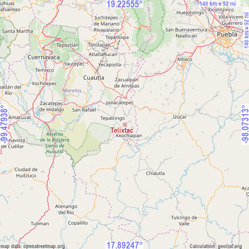
Telixtac GPS coordinates[2]
18° 33' 37.116" North, 98° 46' 34.5" West
| Map corner | latitude | longitude |
|---|---|---|
| Upper-left | 19.22555°, | -99.47938° |
| Center: | 18.56031°, | -98.77625° |
| Lower-right: | 17.89247°, | -98.07313° |
| Map W x H: | 148.2×148.2 km | = 92.1×92.1mi |
| max Lat: | 32.7° ⇑71.9% North |
| Telixtac: | 18.56031° |
| min Lat: | ⇓28.1% South 14.53588° |
| min Long | Telixtac | max Long |
| -117.105° | -98.77625° | -86.73105° |
| W 54%⇐ | ⇒46% E |
Elevation
Elevation of Telixtac is 1104 m = 3622 ft, and this is 149.7 m = 491 ft below average elevation for this country.
| Max E: |
3497 m = 11473 ft | 58% |
| Avg. | 1253.7 m = 4113 ft | |
| Telixtac | 1104 m = 3622 ft | |
Min E: |
-1 m = -3 ft | 42% |
See also: Mexico elevation on elevation.city.
Geographical zone
Telixtac is located in North Torrid zone (between Equator and Tropic of Cancer). Distance of this Northern Tropic circle is 542.2 km =336.9 mi to North.| Distance of | km | miles | from Telixtac |
|---|---|---|---|
| North Pole | 7943.3 | 4935.7 | to North |
| Arctic Circle | 5337.5 | 3316.6 | to North |
| Tropic Cancer | 542.2 | 336.9 | to North |
| Equator | 2063.7 | 1282.3 | to South |


Nearby cities:
15 places around Telixtac: (largest is in red/bold)
• Atlacahualoya
5.4 km =3.4 mi,  114°
114°
• Atotonilco
11.5 km =7.1 mi,  329°
329°
• Axochiapan
6.9 km =4.3 mi,  159°
159°
• Ixtlilco el Chico
7.5 km =4.7 mi,  268°
268°
• Jonacatepec
13.7 km =8.5 mi,  347°
347°
• Lagunillas de Rayón (Alchichica)
11.7 km =7.3 mi,  135°
135°
• Marcelino Rodríguez (San Ignacio)
4 km =2.5 mi,  59°
59°
• Quebrantadero
4.3 km =2.7 mi,  200°
200°
• Tenango
7.4 km =4.6 mi,  20°
20°
• Teotlalco
10.1 km =6.3 mi,  181°
181°
• Tepalcingo
8.2 km =5.1 mi,  297°
297°
• Tepexco
12.8 km =8 mi,  44°
44°
• Tetelilla
5.9 km =3.7 mi,  2°
2°
• Tlalayo
9.7 km =6 mi,  129°
129°
• Tzicatlán
12.4 km =7.7 mi,  169°
169°
Sources, notices
• [Note1] Compared only with cities in Mexico existing in our database
• [Src1] Map data: © OpenStreetMap contributors (CC-BY-SA)
• [Src2] Other city data from geonames.org with taken over terms of usage.
• [Src3] Geographical zone / Annual Mean Temperature by Robert A. Rohde @ Wikipedia
