Tepalcingo geodata
Tepalcingo (Morelos) is a seat of a second-order administrative division; located in Mexico in America/Mexico_City (GMT-6) time zone. With population of 12,053 people, there are 801 cities with bigger population in this country. Compared to other cities in Mexico, 71.5% of cities are located further ↑North; 52.9% of cities are located further ←West and 55.8% of cities have higher elevation than Tepalcingo. Note1


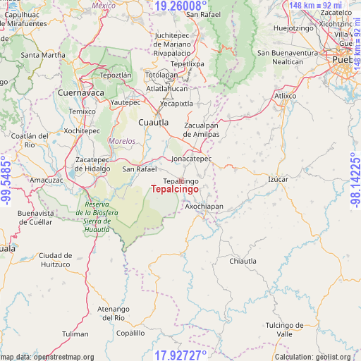
Tepalcingo GPS coordinates[2]
18° 35' 41.928" North, 98° 50' 43.332" West
| Map corner | latitude | longitude |
|---|---|---|
| Upper-left | 19.26008°, | -99.5485° |
| Center: | 18.59498°, | -98.84537° |
| Lower-right: | 17.92727°, | -98.14225° |
| Map W x H: | 148.2×148.2 km | = 92.1×92.1mi |
| max Lat: | 32.7° ⇑71.5% North |
| Tepalcingo: | 18.59498° |
| min Lat: | ⇓28.5% South 14.53588° |
| min Long | Tepalcingo | max Long |
| -117.105° | -98.84537° | -86.73105° |
| W 52.9%⇐ | ⇒47.1% E |
Elevation
Elevation of Tepalcingo is 1166 m = 3825 ft, and this is 87.7 m = 288 ft below average elevation for this country.
| Max E: |
3497 m = 11473 ft | 55.8% |
| Avg. | 1253.7 m = 4113 ft | |
| Tepalcingo | 1166 m = 3825 ft | |
Min E: |
-1 m = -3 ft | 44.2% |
See also: Mexico elevation on elevation.city.
Geographical zone
Tepalcingo is located in North Torrid zone (between Equator and Tropic of Cancer). Distance of this Northern Tropic circle is 538.4 km =334.5 mi to North.| Distance of | km | miles | from Tepalcingo |
|---|---|---|---|
| North Pole | 7939.5 | 4933.4 | to North |
| Arctic Circle | 5333.6 | 3314.1 | to North |
| Tropic Cancer | 538.4 | 334.5 | to North |
| Equator | 2067.6 | 1284.7 | to South |


Nearby cities:
15 places around Tepalcingo: (largest is in red/bold)
• Amacuitlapilco
11.8 km =7.3 mi,  17°
17°
• Atlacahualoya
13.6 km =8.5 mi,  116°
116°
• Atotonilco
6.2 km =3.9 mi,  13°
13°
• Axochiapan
14.1 km =8.8 mi,  136°
136°
• Chalcatzingo
12.9 km =8 mi,  35°
35°
• Huitchila
9.7 km =6 mi,  300°
300°
• Huitzililla
12.3 km =7.6 mi,  333°
333°
• Ixtlilco el Chico
4.1 km =2.5 mi,  182°
182°
• Jonacatepec
10.5 km =6.5 mi, 24°
• Marcelino Rodríguez (San Ignacio)
10.9 km =6.8 mi,  99°
99°
• Quebrantadero
9.8 km =6.1 mi, 143°
• Telixtac
8.2 km =5.1 mi, 117°
• Tenango
10.3 km =6.4 mi,  72°
72°
• Tetelilla
7.8 km =4.8 mi, 74°
• Zacapalco
13 km =8.1 mi,  292°
292°
Sources, notices
• [Note1] Compared only with cities in Mexico existing in our database
• [Src1] Map data: © OpenStreetMap contributors (CC-BY-SA)
• [Src2] Other city data from geonames.org with taken over terms of usage.
• [Src3] Geographical zone / Annual Mean Temperature by Robert A. Rohde @ Wikipedia
