Tlalayo geodata
Tlalayo (Morelos) is a populated place; located in Mexico in America/Mexico_City (GMT-6) time zone. With population of 698 people, there are 12480 cities with bigger population in this country. Compared to other cities in Mexico, 72.6% of cities are located further ↑North; 55% of cities are located further ←West and 59.9% of cities have higher elevation than Tlalayo. Note1


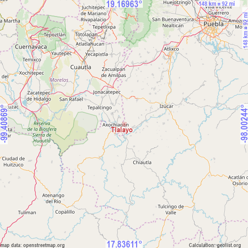
Tlalayo GPS coordinates[2]
18° 30' 15.012" North, 98° 42' 20.016" West
| Map corner | latitude | longitude |
|---|---|---|
| Upper-left | 19.16963°, | -99.40869° |
| Center: | 18.50417°, | -98.70556° |
| Lower-right: | 17.83611°, | -98.00244° |
| Map W x H: | 148.3×148.3 km | = 92.1×92.1mi |
| max Lat: | 32.7° ⇑72.6% North |
| Tlalayo: | 18.50417° |
| min Lat: | ⇓27.4% South 14.53588° |
| min Long | Tlalayo | max Long |
| -117.105° | -98.70556° | -86.73105° |
| W 55%⇐ | ⇒45% E |
Elevation
Elevation of Tlalayo is 1009 m = 3310 ft, and this is 244.7 m = 803 ft below average elevation for this country.
| Max E: |
3497 m = 11473 ft | 59.9% |
| Avg. | 1253.7 m = 4113 ft | |
| Tlalayo | 1009 m = 3310 ft | |
Min E: |
-1 m = -3 ft | 40.1% |
See also: Mexico elevation on elevation.city.
Geographical zone
Tlalayo is located in North Torrid zone (between Equator and Tropic of Cancer). Distance of this Northern Tropic circle is 548.4 km =340.8 mi to North.| Distance of | km | miles | from Tlalayo |
|---|---|---|---|
| North Pole | 7949.6 | 4939.7 | to North |
| Arctic Circle | 5343.7 | 3320.4 | to North |
| Tropic Cancer | 548.4 | 340.8 | to North |
| Equator | 2057.5 | 1278.5 | to South |


Nearby cities:
15 places around Tlalayo: (largest is in red/bold)
• Ahuehuetzingo
7.6 km =4.7 mi,  104°
104°
• Atencingo
10.6 km =6.6 mi,  84°
84°
• Atlacahualoya
4.8 km =3 mi,  327°
327°
• Axochiapan
5.1 km =3.2 mi,  267°
267°
• Buenavista de Benito Juárez
8.7 km =5.4 mi,  124°
124°
• Don Roque
8.7 km =5.4 mi,  108°
108°
• Lagunillas de Rayón (Alchichica)
2.2 km =1.4 mi,  157°
157°
• Marcelino Rodríguez (San Ignacio)
9.2 km =5.7 mi, 334°
• Quebrantadero
9.2 km =5.7 mi,  284°
284°
• San Isidro el Organal
9.5 km =5.9 mi,  67°
67°
• San Miguel Tecolacio
8 km =5 mi,  149°
149°
• Telixtac
9.7 km =6 mi,  309°
309°
• Teotlalco
8.6 km =5.3 mi,  243°
243°
• Tlancualpican
7.9 km =4.9 mi,  175°
175°
• Tzicatlán
8 km =5 mi,  221°
221°
Sources, notices
• [Note1] Compared only with cities in Mexico existing in our database
• [Src1] Map data: © OpenStreetMap contributors (CC-BY-SA)
• [Src2] Other city data from geonames.org with taken over terms of usage.
• [Src3] Geographical zone / Annual Mean Temperature by Robert A. Rohde @ Wikipedia
