Soto la Marina geodata
Soto la Marina (Tamaulipas) is a seat of a second-order administrative division; located in Mexico in America/Monterrey (GMT-6) time zone. With population of 10,620 people, there are 895 cities with bigger population in this country. Compared to other cities in Mexico, 89.4% of cities are located further ↓South; 61.1% of cities are located further ←West and 91.6% of cities have higher elevation than Soto la Marina. Note1


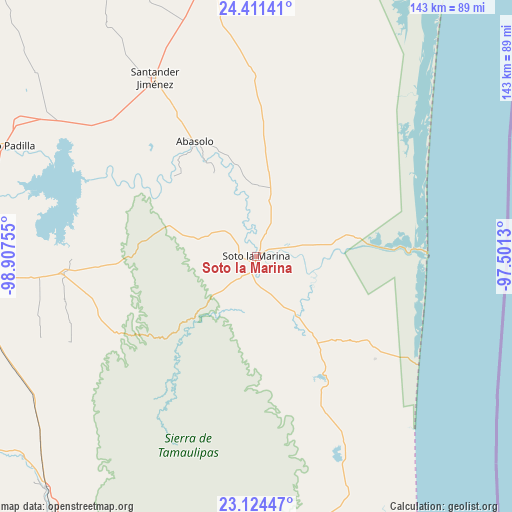
Soto la Marina GPS coordinates[2]
23° 46' 10.308" North, 98° 12' 15.912" West
| Map corner | latitude | longitude |
|---|---|---|
| Upper-left | 24.41141°, | -98.90755° |
| Center: | 23.76953°, | -98.20442° |
| Lower-right: | 23.12447°, | -97.5013° |
| Map W x H: | 143.1×143.1 km | = 88.9×88.9mi |
| max Lat: | 32.7° ⇑10.6% North |
| Soto la Marina: | 23.76953° |
| min Lat: | ⇓89.4% South 14.53588° |
| min Long | Soto la Marina | max Long |
| -117.105° | -98.20442° | -86.73105° |
| W 61.1%⇐ | ⇒38.9% E |
Elevation
Elevation of Soto la Marina is 20 m = 66 ft, and this is 1233.7 m = 4048 ft below average elevation for this country.
| Max E: |
3497 m = 11473 ft | 91.6% |
| Avg. | 1253.7 m = 4113 ft | |
| Soto la Marina | 20 m = 66 ft | |
Min E: |
-1 m = -3 ft | 8.4% |
See also: Mexico elevation on elevation.city.
Geographical zone
Soto la Marina is located in North temperate zone (between Tropic of Cancer and the Arctic Circle). Distance of this Northern Tropic circle is 37 km =23 mi to South.| Distance of | km | miles | from Soto la Marina |
|---|---|---|---|
| North Pole | 7364.1 | 4575.8 | to North |
| Arctic Circle | 4758.3 | 2956.7 | to North |
| Tropic Cancer | 37 | 23 | to South |
| Equator | 2642.9 | 1642.2 | to South |


Nearby cities:
15 places around Soto la Marina: (largest is in red/bold)
• Abasolo
36.4 km =22.6 mi,  331°
331°
• Allende
48 km =29.8 mi, 333°
• Casas
54.4 km =33.8 mi,  264°
264°
• Guadalupe Victoria
34.9 km =21.7 mi,  355°
355°
• Guemes
83.2 km =51.7 mi,  281°
281°
• La Pesca
43.5 km =27 mi,  87°
87°
• Las Compuertas
86.2 km =53.6 mi,  230°
230°
• Manuel Ávila Camacho
81.5 km =50.6 mi, 262°
• Miguel de la Madrid
45.9 km =28.5 mi, 88°
• Nicolás Bravo
26.4 km =16.4 mi,  347°
347°
• Nueva Villa de Padilla
77.3 km =48 mi,  293°
293°
• Nuevo Morelos
28.8 km =17.9 mi, 333°
• Nuevo Progreso
70.9 km =44.1 mi,  158°
158°
• Santander Jiménez
57.3 km =35.6 mi, 330°
• Tampiquito
7.2 km =4.5 mi,  7°
7°
Sources, notices
• [Note1] Compared only with cities in Mexico existing in our database
• [Src1] Map data: © OpenStreetMap contributors (CC-BY-SA)
• [Src2] Other city data from geonames.org with taken over terms of usage.
• [Src3] Geographical zone / Annual Mean Temperature by Robert A. Rohde @ Wikipedia
