Santiago Tulantepec geodata
Santiago Tulantepec (Hidalgo) is a seat of a second-order administrative division; located in Mexico in America/Mexico_City (GMT-6) time zone. With population of 16,078 people, there are 598 cities with bigger population in this country. Compared to other cities in Mexico, 57.8% of cities are located further ↓South; 59.2% of cities are located further ←West and 82.3% of cities have lower elevation than Santiago Tulantepec. Note1


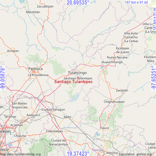
Santiago Tulantepec GPS coordinates[2]
20° 2' 10.248" North, 98° 21' 20.268" West
| Map corner | latitude | longitude |
|---|---|---|
| Upper-left | 20.69535°, | -99.05876° |
| Center: | 20.03618°, | -98.35563° |
| Lower-right: | 19.37423°, | -97.65251° |
| Map W x H: | 146.9×146.9 km | = 91.3×91.3mi |
| max Lat: | 32.7° ⇑42.2% North |
| Santiago Tulantepec: | 20.03618° |
| min Lat: | ⇓57.8% South 14.53588° |
| min Long | Santiago Tulant | max Long |
| -117.105° | -98.35563° | -86.73105° |
| W 59.2%⇐ | ⇒40.8% E |
Elevation
Elevation of Santiago Tulantepec is 2196 m = 7205 ft, and this is 942.3 m = 3092 ft above average elevation for this country.
| Max E: |
3497 m = 11473 ft | 17.7% |
| Santiago Tulantepec | 2196 m 7205 ft | |
| Avg. | 1253.7 m = 4113 ft | |
Min E: |
-1 m = -3 ft | 82.3% |
See also: Mexico elevation on elevation.city.
Geographical zone
Santiago Tulantepec is located in North Torrid zone (between Equator and Tropic of Cancer). Distance of this Northern Tropic circle is 378.1 km =234.9 mi to North.| Distance of | km | miles | from Santiago Tulantepec |
|---|---|---|---|
| North Pole | 7779.2 | 4833.8 | to North |
| Arctic Circle | 5173.4 | 3214.6 | to North |
| Tropic Cancer | 378.1 | 234.9 | to North |
| Equator | 2227.8 | 1384.3 | to South |


Nearby cities:
15 places around Santiago Tulantepec: (largest is in red/bold)
• Almoloya
4.3 km =2.7 mi,  110°
110°
• Cerro Verde
6.8 km =4.2 mi,  71°
71°
• Cuautepec de Hinojosa
4.8 km =3 mi,  90°
90°
• El Tepeyac
5 km =3.1 mi, 71°
• Fraccionamiento del Magisterio Tulancinguense
6.4 km =4 mi,  314°
314°
• La Joya
2.4 km =1.5 mi,  285°
285°
• Loma Bonita
5.7 km =3.5 mi, 65°
• Los Romeros
6.2 km =3.9 mi,  263°
263°
• Pedregal de San Francisco
6 km =3.7 mi,  303°
303°
• Pedregal de San José
6.3 km =3.9 mi, 301°
• Santa María Nativitas
6.3 km =3.9 mi, 87°
• Texcaltepec
3.4 km =2.1 mi,  101°
101°
• Tezoquipa
2.1 km =1.3 mi, 99°
• Tulancingo
5.3 km =3.3 mi,  351°
351°
• Ventoquipa
1.9 km =1.2 mi, 98°
Sources, notices
• [Note1] Compared only with cities in Mexico existing in our database
• [Src1] Map data: © OpenStreetMap contributors (CC-BY-SA)
• [Src2] Other city data from geonames.org with taken over terms of usage.
• [Src3] Geographical zone / Annual Mean Temperature by Robert A. Rohde @ Wikipedia
