Texcaltepec geodata
Texcaltepec (Hidalgo) is a populated place; located in Mexico in America/Mexico_City (GMT-6) time zone. With population of 1,843 people, there are 4715 cities with bigger population in this country. Compared to other cities in Mexico, 57.6% of cities are located further ↓South; 59.6% of cities are located further ←West and 85.1% of cities have lower elevation than Texcaltepec. Note1


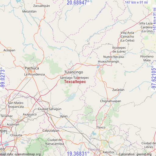
Texcaltepec GPS coordinates[2]
20° 1' 49.008" North, 98° 19' 27.012" West
| Map corner | latitude | longitude |
|---|---|---|
| Upper-left | 20.68947°, | -99.0273° |
| Center: | 20.03028°, | -98.32417° |
| Lower-right: | 19.36831°, | -97.62105° |
| Map W x H: | 146.9×146.9 km | = 91.3×91.3mi |
| max Lat: | 32.7° ⇑42.4% North |
| Texcaltepec: | 20.03028° |
| min Lat: | ⇓57.6% South 14.53588° |
| min Long | Texcaltepec | max Long |
| -117.105° | -98.32417° | -86.73105° |
| W 59.6%⇐ | ⇒40.4% E |
Elevation
Elevation of Texcaltepec is 2260 m = 7415 ft, and this is 1006.3 m = 3302 ft above average elevation for this country.
| Max E: |
3497 m = 11473 ft | 14.9% |
| Texcaltepec | 2260 m 7415 ft | |
| Avg. | 1253.7 m = 4113 ft | |
Min E: |
-1 m = -3 ft | 85.1% |
See also: Mexico elevation on elevation.city.
Geographical zone
Texcaltepec is located in North Torrid zone (between Equator and Tropic of Cancer). Distance of this Northern Tropic circle is 378.8 km =235.4 mi to North.| Distance of | km | miles | from Texcaltepec |
|---|---|---|---|
| North Pole | 7779.9 | 4834.2 | to North |
| Arctic Circle | 5174 | 3215 | to North |
| Tropic Cancer | 378.8 | 235.4 | to North |
| Equator | 2227.2 | 1383.9 | to South |


Nearby cities:
15 places around Texcaltepec: (largest is in red/bold)
• Almoloya
1.1 km =0.7 mi,  136°
136°
• Buenos Aires
3.5 km =2.2 mi,  106°
106°
• Cerro Verde
4.2 km =2.6 mi,  48°
48°
• Cuautepec de Hinojosa
1.6 km =1 mi,  68°
68°
• El Capulín
5.5 km =3.4 mi,  115°
115°
• El Tepeyac
2.7 km =1.7 mi,  31°
31°
• Guadalupe Victoria
5.9 km =3.7 mi,  82°
82°
• La Joya
5.8 km =3.6 mi,  282°
282°
• Loma Bonita
3.5 km =2.2 mi, 32°
• San Juan Hueyapan
4.4 km =2.7 mi,  90°
90°
• San Lorenzo Sayula
5.3 km =3.3 mi,  148°
148°
• Santa María Nativitas
3.2 km =2 mi, 72°
• Santiago Tulantepec
3.4 km =2.1 mi, 281°
• Tezoquipa
1.2 km =0.7 mi, 284°
• Ventoquipa
1.5 km =0.9 mi, 284°
Sources, notices
• [Note1] Compared only with cities in Mexico existing in our database
• [Src1] Map data: © OpenStreetMap contributors (CC-BY-SA)
• [Src2] Other city data from geonames.org with taken over terms of usage.
• [Src3] Geographical zone / Annual Mean Temperature by Robert A. Rohde @ Wikipedia
