Santa María Tiltepec geodata
Santa María Tiltepec (Oaxaca) is a populated place; located in Mexico in America/Mexico_City (GMT-6) time zone. With population of 2,163 people, there are 4064 cities with bigger population in this country. Compared to other cities in Mexico, 97.1% of cities are located further ↑North; 72.8% of cities are located further ←West and 68.8% of cities have higher elevation than Santa María Tiltepec. Note1


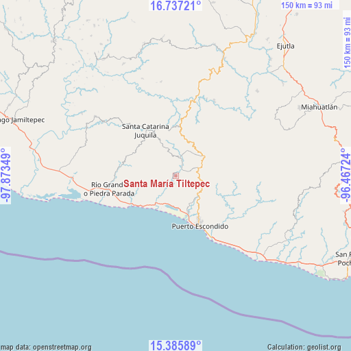
Santa María Tiltepec GPS coordinates[2]
16° 3' 45.72" North, 97° 10' 13.296" West
| Map corner | latitude | longitude |
|---|---|---|
| Upper-left | 16.73721°, | -97.87349° |
| Center: | 16.0627°, | -97.17036° |
| Lower-right: | 15.38589°, | -96.46724° |
| Map W x H: | 150.3×150.3 km | = 93.4×93.4mi |
| max Lat: | 32.7° ⇑97.1% North |
| Santa María Tiltepec: | 16.0627° |
| min Lat: | ⇓2.9% South 14.53588° |
| min Long | Santa María Ti | max Long |
| -117.105° | -97.17036° | -86.73105° |
| W 72.8%⇐ | ⇒27.2% E |
Elevation
Elevation of Santa María Tiltepec is 477 m = 1565 ft, and this is 776.7 m = 2548 ft below average elevation for this country.
| Max E: |
3497 m = 11473 ft | 68.8% |
| Avg. | 1253.7 m = 4113 ft | |
| Santa María Tiltepec | 477 m = 1565 ft | |
Min E: |
-1 m = -3 ft | 31.2% |
See also: Mexico elevation on elevation.city.
Geographical zone
Santa María Tiltepec is located in North Torrid zone (between Equator and Tropic of Cancer). Distance of this Northern Tropic circle is 819.9 km =509.5 mi to North.| Distance of | km | miles | from Santa María Tiltepec |
|---|---|---|---|
| North Pole | 8221.1 | 5108.4 | to North |
| Arctic Circle | 5615.2 | 3489.1 | to North |
| Tropic Cancer | 819.9 | 509.5 | to North |
| Equator | 1786 | 1109.8 | to South |


Nearby cities:
15 places around Santa María Tiltepec: (largest is in red/bold)
• Cañada de Guadalupe
10.8 km =6.7 mi,  6°
6°
• Cerro del Aire
6.4 km =4 mi,  325°
325°
• El Huarumbo
12 km =7.5 mi,  131°
131°
• Hidalgo Manialtepec
14.5 km =9 mi,  217°
217°
• Las Palmas
15.5 km =9.6 mi,  56°
56°
• San Andrés Copala
7.6 km =4.7 mi,  158°
158°
• San Gabriel Mixtepec
10.1 km =6.3 mi,  68°
68°
• San José Atotonilco
4.9 km =3 mi,  346°
346°
• San José Manialtepec
12.6 km =7.8 mi, 218°
• San Juan Lachao
11.8 km =7.3 mi,  24°
24°
• San Pedro Mixtepec
13.2 km =8.2 mi, 132°
• Santa Lucía Teotepec
9.8 km =6.1 mi,  335°
335°
• Santa María Temaxcaltepec
11.8 km =7.3 mi, 345°
• Santiago Cuixtla
1.7 km =1.1 mi,  267°
267°
• Santos Reyes Nopala
5.6 km =3.5 mi,  29°
29°
Sources, notices
• [Note1] Compared only with cities in Mexico existing in our database
• [Src1] Map data: © OpenStreetMap contributors (CC-BY-SA)
• [Src2] Other city data from geonames.org with taken over terms of usage.
• [Src3] Geographical zone / Annual Mean Temperature by Robert A. Rohde @ Wikipedia
