San Andrés Copala geodata
San Andrés Copala (Oaxaca) is a populated place; located in Mexico in America/Mexico_City (GMT-6) time zone. With population of 840 people, there are 10414 cities with bigger population in this country. Compared to other cities in Mexico, 97.3% of cities are located further ↑North; 73% of cities are located further ←West and 71.8% of cities have higher elevation than San Andrés Copala. Note1


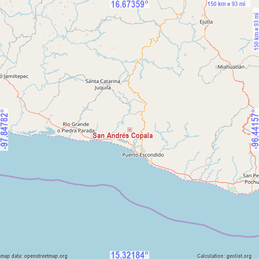
San Andrés Copala GPS coordinates[2]
15° 59' 55.896" North, 97° 8' 40.884" West
| Map corner | latitude | longitude |
|---|---|---|
| Upper-left | 16.67359°, | -97.84782° |
| Center: | 15.99886°, | -97.14469° |
| Lower-right: | 15.32184°, | -96.44157° |
| Map W x H: | 150.3×150.3 km | = 93.4×93.4mi |
| max Lat: | 32.7° ⇑97.3% North |
| San Andrés Copala: | 15.99886° |
| min Lat: | ⇓2.7% South 14.53588° |
| min Long | San Andrés Cop | max Long |
| -117.105° | -97.14469° | -86.73105° |
| W 73%⇐ | ⇒27% E |
Elevation
Elevation of San Andrés Copala is 335 m = 1099 ft, and this is 918.7 m = 3014 ft below average elevation for this country.
| Max E: |
3497 m = 11473 ft | 71.8% |
| Avg. | 1253.7 m = 4113 ft | |
| San Andrés Copala | 335 m = 1099 ft | |
Min E: |
-1 m = -3 ft | 28.2% |
See also: Mexico elevation on elevation.city.
Geographical zone
San Andrés Copala is located in North Torrid zone (between Equator and Tropic of Cancer). Distance of this Northern Tropic circle is 827 km =513.9 mi to North.| Distance of | km | miles | from San Andrés Copala |
|---|---|---|---|
| North Pole | 8228.2 | 5112.8 | to North |
| Arctic Circle | 5622.3 | 3493.5 | to North |
| Tropic Cancer | 827 | 513.9 | to North |
| Equator | 1778.9 | 1105.4 | to South |


Nearby cities:
15 places around San Andrés Copala: (largest is in red/bold)
• Bajos de Chila
8.8 km =5.5 mi,  163°
163°
• Cerro del Aire
13.9 km =8.6 mi,  332°
332°
• Colonia Libertad
17.3 km =10.7 mi,  146°
146°
• El Huarumbo
6.4 km =4 mi,  97°
97°
• Hidalgo Manialtepec
12.4 km =7.7 mi,  249°
249°
• La Reforma
17.4 km =10.8 mi,  94°
94°
• Puerto Escondido
16 km =9.9 mi, 153°
• San Gabriel Mixtepec
12.7 km =7.9 mi,  31°
31°
• San José Atotonilco
12.5 km =7.8 mi,  341°
341°
• San José Manialtepec
11 km =6.8 mi,  255°
255°
• San Pedro Mixtepec
7.2 km =4.5 mi,  105°
105°
• Santa Lucía Teotepec
17.4 km =10.8 mi, 336°
• Santa María Tiltepec
7.6 km =4.7 mi, 338°
• Santiago Cuixtla
8.3 km =5.2 mi, 327°
• Santos Reyes Nopala
12 km =7.5 mi,  0°
0°
Sources, notices
• [Note1] Compared only with cities in Mexico existing in our database
• [Src1] Map data: © OpenStreetMap contributors (CC-BY-SA)
• [Src2] Other city data from geonames.org with taken over terms of usage.
• [Src3] Geographical zone / Annual Mean Temperature by Robert A. Rohde @ Wikipedia
