San Gabriel Mixtepec geodata
San Gabriel Mixtepec (Oaxaca) is a populated place; located in Mexico in America/Mexico_City (GMT-6) time zone. With population of 3,518 people, there are 2592 cities with bigger population in this country. Compared to other cities in Mexico, 96.9% of cities are located further ↑North; 73.8% of cities are located further ←West and 65% of cities have higher elevation than San Gabriel Mixtepec. Note1


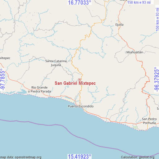
San Gabriel Mixtepec GPS coordinates[2]
16° 5' 45.348" North, 97° 4' 56.532" West
| Map corner | latitude | longitude |
|---|---|---|
| Upper-left | 16.77033°, | -97.7855° |
| Center: | 16.09593°, | -97.08237° |
| Lower-right: | 15.41923°, | -96.37925° |
| Map W x H: | 150.2×150.2 km | = 93.3×93.3mi |
| max Lat: | 32.7° ⇑96.9% North |
| San Gabriel Mixtepec: | 16.09593° |
| min Lat: | ⇓3.1% South 14.53588° |
| min Long | San Gabriel Mix | max Long |
| -117.105° | -97.08237° | -86.73105° |
| W 73.8%⇐ | ⇒26.2% E |
Elevation
Elevation of San Gabriel Mixtepec is 685 m = 2247 ft, and this is 568.7 m = 1866 ft below average elevation for this country.
| Max E: |
3497 m = 11473 ft | 65% |
| Avg. | 1253.7 m = 4113 ft | |
| San Gabriel Mixtepec | 685 m = 2247 ft | |
Min E: |
-1 m = -3 ft | 35% |
See also: Mexico elevation on elevation.city.
Geographical zone
San Gabriel Mixtepec is located in North Torrid zone (between Equator and Tropic of Cancer). Distance of this Northern Tropic circle is 816.2 km =507.2 mi to North.| Distance of | km | miles | from San Gabriel Mixtepec |
|---|---|---|---|
| North Pole | 8217.4 | 5106.1 | to North |
| Arctic Circle | 5611.5 | 3486.8 | to North |
| Tropic Cancer | 816.2 | 507.2 | to North |
| Equator | 1789.7 | 1112.1 | to South |


Nearby cities:
15 places around San Gabriel Mixtepec: (largest is in red/bold)
• Cañada de Guadalupe
10.8 km =6.7 mi,  310°
310°
• Cerro del Aire
13.1 km =8.1 mi,  276°
276°
• El Huarumbo
11.6 km =7.2 mi,  181°
181°
• La Reforma
16.2 km =10.1 mi,  138°
138°
• Las Palmas
6 km =3.7 mi,  36°
36°
• San Andrés Copala
12.7 km =7.9 mi,  211°
211°
• San José Atotonilco
10.6 km =6.6 mi, 275°
• San Juan Lachao
8.3 km =5.2 mi,  327°
327°
• San Pedro Mixtepec
12.7 km =7.9 mi, 178°
• Santa Lucía Teotepec
14.5 km =9 mi,  291°
291°
• Santa María Temaxcaltepec
14.5 km =9 mi,  302°
302°
• Santa María Tiltepec
10.1 km =6.3 mi,  248°
248°
• Santiago Cuixtla
11.7 km =7.3 mi, 251°
• Santos Reyes Nopala
6.7 km =4.2 mi, 280°
• Soledad Piedra Larga
7.4 km =4.6 mi,  54°
54°
Sources, notices
• [Note1] Compared only with cities in Mexico existing in our database
• [Src1] Map data: © OpenStreetMap contributors (CC-BY-SA)
• [Src2] Other city data from geonames.org with taken over terms of usage.
• [Src3] Geographical zone / Annual Mean Temperature by Robert A. Rohde @ Wikipedia
