Santa María Ixcotla geodata
Santa María Ixcotla (Tlaxcala) is a populated place; located in Mexico in America/Mexico_City (GMT-6) time zone. With population of 721 people, there are 12102 cities with bigger population in this country. Compared to other cities in Mexico, 55.7% of cities are located further ↑North; 59.6% of cities are located further ←West and 95.6% of cities have lower elevation than Santa María Ixcotla. Note1


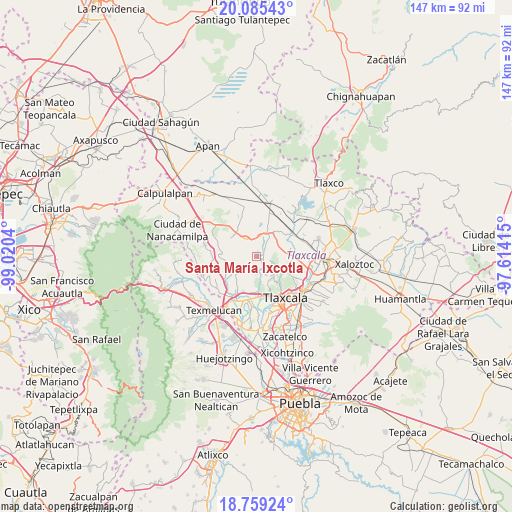
Santa María Ixcotla GPS coordinates[2]
19° 25' 25.284" North, 98° 19' 2.172" West
| Map corner | latitude | longitude |
|---|---|---|
| Upper-left | 20.08543°, | -99.0204° |
| Center: | 19.42369°, | -98.31727° |
| Lower-right: | 18.75924°, | -97.61415° |
| Map W x H: | 147.5×147.5 km | = 91.7×91.7mi |
| max Lat: | 32.7° ⇑55.7% North |
| Santa María Ixcotla: | 19.42369° |
| min Lat: | ⇓44.3% South 14.53588° |
| min Long | Santa María Ix | max Long |
| -117.105° | -98.31727° | -86.73105° |
| W 59.6%⇐ | ⇒40.4% E |
Elevation
Elevation of Santa María Ixcotla is 2611 m = 8566 ft, and this is 1357.3 m = 4453 ft above average elevation for this country.
| Max E: |
3497 m = 11473 ft | 4.4% |
| Santa María Ixcotla | 2611 m 8566 ft | |
| Avg. | 1253.7 m = 4113 ft | |
Min E: |
-1 m = -3 ft | 95.6% |
See also: Mexico elevation on elevation.city.
Geographical zone
Santa María Ixcotla is located in North Torrid zone (between Equator and Tropic of Cancer). Distance of this Northern Tropic circle is 446.2 km =277.3 mi to North.| Distance of | km | miles | from Santa María Ixcotla |
|---|---|---|---|
| North Pole | 7847.4 | 4876.1 | to North |
| Arctic Circle | 5241.5 | 3256.9 | to North |
| Tropic Cancer | 446.2 | 277.3 | to North |
| Equator | 2159.7 | 1342 | to South |


Nearby cities:
15 places around Santa María Ixcotla: (largest is in red/bold)
• Barrio de Cuatla
10.9 km =6.8 mi,  78°
78°
• Hueyotlipan
6.1 km =3.8 mi,  328°
328°
• Huiloapan
6.4 km =4 mi,  129°
129°
• La Trinidad Tenexyecac
9.8 km =6.1 mi,  178°
178°
• San Ambrosio Texantla
9.9 km =6.2 mi,  140°
140°
• San Antonio Tecoac
10.5 km =6.5 mi,  185°
185°
• San Francisco Temetzontla
8.7 km =5.4 mi,  159°
159°
• San Lucas Tecopilco
9.5 km =5.9 mi,  42°
42°
• San Marcos Jilotepec
7.9 km =4.9 mi,  229°
229°
• San Simeón Xipetzingo
6.8 km =4.2 mi,  22°
22°
• San Simón Tlatlahuquitepec
10.2 km =6.3 mi,  106°
106°
• Santa Bárbara Acuicultzcatepec
10.1 km =6.3 mi, 75°
• Santa Cruz el Porvenir
10.7 km =6.6 mi,  197°
197°
• Santiago Tlalpan
6 km =3.7 mi,  8°
8°
• Santiago Xochimilco
9.3 km =5.8 mi, 186°
Sources, notices
• [Note1] Compared only with cities in Mexico existing in our database
• [Src1] Map data: © OpenStreetMap contributors (CC-BY-SA)
• [Src2] Other city data from geonames.org with taken over terms of usage.
• [Src3] Geographical zone / Annual Mean Temperature by Robert A. Rohde @ Wikipedia
