San Marcos Jilotepec geodata
San Marcos Jilotepec (Tlaxcala) is a populated place; located in Mexico in America/Mexico_City (GMT-6) time zone. With population of 553 people, there are 15422 cities with bigger population in this country. Compared to other cities in Mexico, 56.8% of cities are located further ↑North; 59% of cities are located further ←West and 92.9% of cities have lower elevation than San Marcos Jilotepec. Note1
Current local time in San Marcos Jilotepec:
08:36 AM, WednesdayDifference from your time zone: hours


San Marcos Jilotepec GPS coordinates[2]
19° 22' 40.116" North, 98° 22' 27.804" West
| Map corner | latitude | longitude |
|---|---|---|
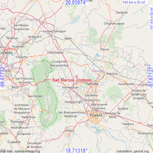
| Upper-left | 20.03974°, | -99.07752° |
| Center: | 19.37781°, | -98.37439° |
| Lower-right: | 18.71318°, | -97.67127° |
| Map W x H: | 147.5×147.5 km | = 91.7×91.7mi |
| max Lat: | 32.7° ⇑56.8% North |
| San Marcos Jilotepec: | 19.37781° |
| min Lat: | ⇓43.2% South 14.53588° |
| min Long | San Marcos Jilo | max Long |
| -117.105° | -98.37439° | -86.73105° |
| W 59%⇐ | ⇒41% E |
Elevation
Elevation of San Marcos Jilotepec is 2521 m = 8271 ft, and this is 1267.3 m = 4158 ft above average elevation for this country.
| Max E: |
3497 m = 11473 ft | 7.1% |
| San Marcos Jilotepec | 2521 m 8271 ft | |
| Avg. | 1253.7 m = 4113 ft | |
Min E: |
-1 m = -3 ft | 92.9% |
See also: Mexico elevation on elevation.city.
Geographical zone
San Marcos Jilotepec is located in North Torrid zone (between Equator and Tropic of Cancer). Distance of this Northern Tropic circle is 451.3 km =280.4 mi to North.| Distance of | km | miles | from San Marcos Jilotepec |
|---|---|---|---|
| North Pole | 7852.5 | 4879.3 | to North |
| Arctic Circle | 5246.6 | 3260.1 | to North |
| Tropic Cancer | 451.3 | 280.4 | to North |
| Equator | 2154.6 | 1338.8 | to South |


Nearby cities:
15 places around San Marcos Jilotepec: (largest is in red/bold)
• Alpotzonga de Lira y Ortega
6.2 km =3.9 mi,  263°
263°
• Espíritu Santo
7 km =4.3 mi,  231°
231°
• La Trinidad Tenexyecac
7.8 km =4.8 mi,  126°
126°
• San Antonio Atotonilco
9.6 km =6 mi,  267°
267°
• San Antonio Tecoac
7.3 km =4.5 mi,  136°
136°
• San Francisco Temetzontla
9.5 km =5.9 mi,  108°
108°
• San Jorge Tezoquipan
9 km =5.6 mi, 134°
• Santa Ana Nopalucan
9.9 km =6.2 mi,  154°
154°
• Santa Cruz el Porvenir
5.8 km =3.6 mi, 151°
• Santa Inés Tecuexcomac
9.8 km =6.1 mi,  162°
162°
• Santa Justina Ecatepec
7.7 km =4.8 mi, 164°
• Santa María Ixcotla
7.9 km =4.9 mi,  49°
49°
• Santiago Xochimilco
6.4 km =4 mi, 129°
• Villa Mariano Matamoros
5.7 km =3.5 mi,  184°
184°
• Xocoyucan
7.6 km =4.7 mi, 180°
Sources, notices
• [Note1] Compared only with cities in Mexico existing in our database
• [Src1] Map data: © OpenStreetMap contributors (CC-BY-SA)
• [Src2] Other city data from geonames.org with taken over terms of usage.
• [Src3] Geographical zone / Annual Mean Temperature by Robert A. Rohde @ Wikipedia
