San Pedro y San Pablo Tequistepec geodata
San Pedro y San Pablo Tequistepec (Oaxaca) is a seat of a second-order administrative division; located in Mexico in America/Mexico_City (GMT-6) time zone. With population of 458 people, there are 16829 cities with bigger population in this country. Compared to other cities in Mexico, 78% of cities are located further ↑North; 67% of cities are located further ←West and 66.2% of cities have lower elevation than San Pedro y San Pablo Tequistepec. Note1
Current local time in San Pedro y San Pablo Tequistepec:
08:28 AM, WednesdayDifference from your time zone: hours


San Pedro y San Pablo Tequistepec GPS coordinates[2]
18° 3' 39.816" North, 97° 43' 5.376" West
| Map corner | latitude | longitude |
|---|---|---|
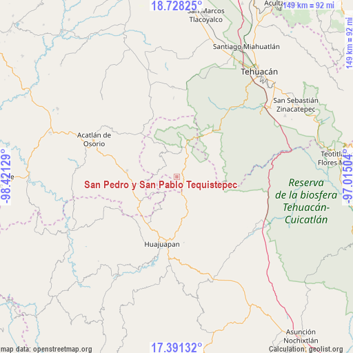
| Upper-left | 18.72825°, | -98.42129° |
| Center: | 18.06106°, | -97.71816° |
| Lower-right: | 17.39132°, | -97.01504° |
| Map W x H: | 148.7×148.7 km | = 92.4×92.4mi |
| max Lat: | 32.7° ⇑78% North |
| San Pedro y San Pablo Tequistepec: | 18.06106° |
| min Lat: | ⇓22% South 14.53588° |
| min Long | San Pedro y San | max Long |
| -117.105° | -97.71816° | -86.73105° |
| W 67%⇐ | ⇒33% E |
Elevation
Elevation of San Pedro y San Pablo Tequistepec is 1855 m = 6086 ft, and this is 601.3 m = 1973 ft above average elevation for this country.
| Max E: |
3497 m = 11473 ft | 33.8% |
| San Pedro y San Pablo Tequistepec | 1855 m 6086 ft | |
| Avg. | 1253.7 m = 4113 ft | |
Min E: |
-1 m = -3 ft | 66.2% |
See also: Mexico elevation on elevation.city.
Geographical zone
San Pedro y San Pablo Tequistepec is located in North Torrid zone (between Equator and Tropic of Cancer). Distance of this Northern Tropic circle is 597.7 km =371.4 mi to North.| Distance of | km | miles | from San Pedro y San Pablo Tequistepec |
|---|---|---|---|
| North Pole | 7998.9 | 4970.3 | to North |
| Arctic Circle | 5393 | 3351.1 | to North |
| Tropic Cancer | 597.7 | 371.4 | to North |
| Equator | 2008.2 | 1247.8 | to South |


Nearby cities:
15 places around San Pedro y San Pablo Tequistepec: (largest is in red/bold)
• Asunción Cuyotepeji
15 km =9.3 mi,  162°
162°
• Chila
18.2 km =11.3 mi,  236°
236°
• Cosoltepec
11.9 km =7.4 mi,  319°
319°
• Francisco Ibarra Ramos
23 km =14.3 mi,  246°
246°
• Petlalcingo
21.2 km =13.2 mi,  277°
277°
• San Miguel Ixitlán
9 km =5.6 mi,  221°
221°
• Santa Gertrudis Salitrillo
19.6 km =12.2 mi,  256°
256°
• Santa María Camotlán
18.5 km =11.5 mi,  171°
171°
• Santiago Chazumba
14.9 km =9.3 mi,  15°
15°
• Santiago Chilixtlahuaca
25.5 km =15.8 mi,  227°
227°
• Santiago Miltepec
9 km =5.6 mi, 160°
• Santo Domingo Tonahuíxtla
24.1 km =15 mi,  311°
311°
• Tepejillo
12.9 km =8 mi,  265°
265°
• Totoltepec de Guerrero
23.3 km =14.5 mi, 321°
• Zapotitlán Palmas
21.8 km =13.5 mi,  209°
209°
Sources, notices
• [Note1] Compared only with cities in Mexico existing in our database
• [Src1] Map data: © OpenStreetMap contributors (CC-BY-SA)
• [Src2] Other city data from geonames.org with taken over terms of usage.
• [Src3] Geographical zone / Annual Mean Temperature by Robert A. Rohde @ Wikipedia
