Cosoltepec geodata
Cosoltepec (Oaxaca) is a seat of a second-order administrative division; located in Mexico in America/Mexico_City (GMT-6) time zone. With population of 379 people, there are 16850 cities with bigger population in this country. Compared to other cities in Mexico, 77% of cities are located further ↑North; 66.2% of cities are located further ←West and 65.1% of cities have lower elevation than Cosoltepec. Note1


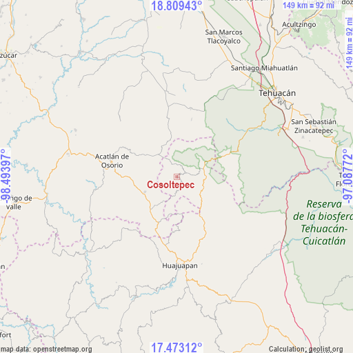
Cosoltepec GPS coordinates[2]
18° 8' 33.18" North, 97° 47' 27.024" West
| Map corner | latitude | longitude |
|---|---|---|
| Upper-left | 18.80943°, | -98.49397° |
| Center: | 18.14255°, | -97.79084° |
| Lower-right: | 17.47312°, | -97.08772° |
| Map W x H: | 148.6×148.6 km | = 92.3×92.3mi |
| max Lat: | 32.7° ⇑77% North |
| Cosoltepec: | 18.14255° |
| min Lat: | ⇓23% South 14.53588° |
| min Long | Cosoltepec | max Long |
| -117.105° | -97.79084° | -86.73105° |
| W 66.2%⇐ | ⇒33.8% E |
Elevation
Elevation of Cosoltepec is 1833 m = 6014 ft, and this is 579.3 m = 1901 ft above average elevation for this country.
| Max E: |
3497 m = 11473 ft | 34.9% |
| Cosoltepec | 1833 m 6014 ft | |
| Avg. | 1253.7 m = 4113 ft | |
Min E: |
-1 m = -3 ft | 65.1% |
See also: Mexico elevation on elevation.city.
Geographical zone
Cosoltepec is located in North Torrid zone (between Equator and Tropic of Cancer). Distance of this Northern Tropic circle is 588.7 km =365.8 mi to North.| Distance of | km | miles | from Cosoltepec |
|---|---|---|---|
| North Pole | 7989.8 | 4964.6 | to North |
| Arctic Circle | 5383.9 | 3345.4 | to North |
| Tropic Cancer | 588.7 | 365.8 | to North |
| Equator | 2017.3 | 1253.5 | to South |


Nearby cities:
15 places around Cosoltepec: (largest is in red/bold)
• Chila
20.6 km =12.8 mi,  201°
201°
• Francisco Ibarra Ramos
22.7 km =14.1 mi,  216°
216°
• Gabino Barreda
17.2 km =10.7 mi,  279°
279°
• Petlalcingo
14.9 km =9.3 mi,  244°
244°
• San Jerónimo Xayacatlán
15.5 km =9.6 mi,  303°
303°
• San Miguel Ixitlán
15.8 km =9.8 mi,  173°
173°
• San Pedro y San Pablo Tequistepec
11.9 km =7.4 mi,  139°
139°
• Santa Gertrudis Salitrillo
17.8 km =11.1 mi, 219°
• Santiago Chazumba
12.9 km =8 mi,  65°
65°
• Santiago Miltepec
20.5 km =12.7 mi,  148°
148°
• Santo Domingo Tonahuíxtla
12.5 km =7.8 mi, 302°
• Tepejillo
11.3 km =7 mi,  207°
207°
• Texcalapa de Juárez
22.6 km =14 mi,  247°
247°
• Totoltepec de Guerrero
11.5 km =7.1 mi,  323°
323°
• Xayacatlán de Bravo
22.1 km =13.7 mi, 298°
Sources, notices
• [Note1] Compared only with cities in Mexico existing in our database
• [Src1] Map data: © OpenStreetMap contributors (CC-BY-SA)
• [Src2] Other city data from geonames.org with taken over terms of usage.
• [Src3] Geographical zone / Annual Mean Temperature by Robert A. Rohde @ Wikipedia
