Totoltepec de Guerrero geodata
Totoltepec de Guerrero (Puebla) is a seat of a second-order administrative division; located in Mexico in America/Mexico_City (GMT-6) time zone. With population of 911 people, there are 9575 cities with bigger population in this country. Compared to other cities in Mexico, 75.9% of cities are located further ↑North; 65.4% of cities are located further ←West and 51.1% of cities have higher elevation than Totoltepec de Guerrero. Note1


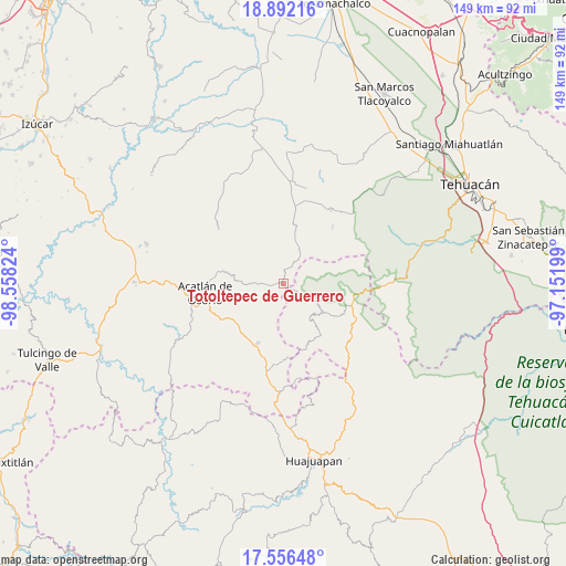
Totoltepec de Guerrero GPS coordinates[2]
18° 13' 32.16" North, 97° 51' 18.396" West
| Map corner | latitude | longitude |
|---|---|---|
| Upper-left | 18.89216°, | -98.55824° |
| Center: | 18.2256°, | -97.85511° |
| Lower-right: | 17.55648°, | -97.15199° |
| Map W x H: | 148.5×148.5 km | = 92.3×92.3mi |
| max Lat: | 32.7° ⇑75.9% North |
| Totoltepec de Guerrero: | 18.2256° |
| min Lat: | ⇓24.1% South 14.53588° |
| min Long | Totoltepec de G | max Long |
| -117.105° | -97.85511° | -86.73105° |
| W 65.4%⇐ | ⇒34.6% E |
Elevation
Elevation of Totoltepec de Guerrero is 1379 m = 4524 ft, and this is 125.3 m = 411 ft above average elevation for this country.
| Max E: |
3497 m = 11473 ft | 51.1% |
| Totoltepec de Guerrero | 1379 m 4524 ft | |
| Avg. | 1253.7 m = 4113 ft | |
Min E: |
-1 m = -3 ft | 48.9% |
See also: Mexico elevation on elevation.city.
Geographical zone
Totoltepec de Guerrero is located in North Torrid zone (between Equator and Tropic of Cancer). Distance of this Northern Tropic circle is 579.4 km =360 mi to North.| Distance of | km | miles | from Totoltepec de Guerrero |
|---|---|---|---|
| North Pole | 7980.6 | 4958.9 | to North |
| Arctic Circle | 5374.7 | 3339.7 | to North |
| Tropic Cancer | 579.4 | 360 | to North |
| Equator | 2026.5 | 1259.2 | to South |


Nearby cities:
15 places around Totoltepec de Guerrero: (largest is in red/bold)
• Acatlán de Osorio
20.6 km =12.8 mi,  262°
262°
• Cosoltepec
11.5 km =7.1 mi,  143°
143°
• Gabino Barreda
12 km =7.5 mi,  238°
238°
• Garzones (Santa Gertrudis)
19.4 km =12.1 mi,  287°
287°
• La Huerta
17 km =10.6 mi,  281°
281°
• Petlalcingo
17 km =10.6 mi,  202°
202°
• San Felipe Otlaltepec
20.3 km =12.6 mi,  344°
344°
• San Jerónimo Xayacatlán
6.1 km =3.8 mi, 264°
• San Vicente Coyotepec
20.1 km =12.5 mi,  7°
7°
• Santiago Chazumba
18.9 km =11.7 mi,  102°
102°
• Santo Domingo Tonahuíxtla
4.4 km =2.7 mi, 235°
• Tepejillo
19.4 km =12.1 mi,  175°
175°
• Tetelcingo
18.2 km =11.3 mi,  274°
274°
• Tianguistengo
17.3 km =10.7 mi, 280°
• Xayacatlán de Bravo
12.8 km =8 mi, 275°
Sources, notices
• [Note1] Compared only with cities in Mexico existing in our database
• [Src1] Map data: © OpenStreetMap contributors (CC-BY-SA)
• [Src2] Other city data from geonames.org with taken over terms of usage.
• [Src3] Geographical zone / Annual Mean Temperature by Robert A. Rohde @ Wikipedia
