San Pedro Ocotepec geodata
San Pedro Ocotepec (Oaxaca) is a populated place; located in Mexico in America/Mexico_City (GMT-6) time zone. With population of 1,224 people, there are 7093 cities with bigger population in this country. Compared to other cities in Mexico, 89.5% of cities are located further ↑North; 82.6% of cities are located further ←West and 56.2% of cities have lower elevation than San Pedro Ocotepec. Note1


San Pedro Ocotepec GPS coordinates[2]
16° 57' 18.036" North, 95° 50' 44.268" West
| Map corner | latitude | longitude |
|---|---|---|
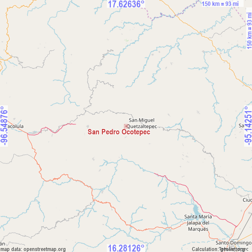
| Upper-left | 17.62636°, | -96.54876° |
| Center: | 16.95501°, | -95.84563° |
| Lower-right: | 16.28126°, | -95.14251° |
| Map W x H: | 149.6×149.6 km | = 93×93mi |
| max Lat: | 32.7° ⇑89.5% North |
| San Pedro Ocotepec: | 16.95501° |
| min Lat: | ⇓10.5% South 14.53588° |
| min Long | San Pedro Ocote | max Long |
| -117.105° | -95.84563° | -86.73105° |
| W 82.6%⇐ | ⇒17.4% E |
Elevation
Elevation of San Pedro Ocotepec is 1627 m = 5338 ft, and this is 373.3 m = 1225 ft above average elevation for this country.
| Max E: |
3497 m = 11473 ft | 43.8% |
| San Pedro Ocotepec | 1627 m 5338 ft | |
| Avg. | 1253.7 m = 4113 ft | |
Min E: |
-1 m = -3 ft | 56.2% |
See also: Mexico elevation on elevation.city.
Geographical zone
San Pedro Ocotepec is located in North Torrid zone (between Equator and Tropic of Cancer). Distance of this Northern Tropic circle is 720.7 km =447.8 mi to North.| Distance of | km | miles | from San Pedro Ocotepec |
|---|---|---|---|
| North Pole | 8121.8 | 5046.7 | to North |
| Arctic Circle | 5516 | 3427.5 | to North |
| Tropic Cancer | 720.7 | 447.8 | to North |
| Equator | 1885.2 | 1171.4 | to South |


Nearby cities:
15 places around San Pedro Ocotepec: (largest is in red/bold)
• Asunción Acatlán
12.9 km =8 mi,  239°
239°
• Cacalotepec
14.8 km =9.2 mi,  307°
307°
• Cerro Moneda
10.1 km =6.3 mi, 309°
• Estancia de Morelos
11.6 km =7.2 mi,  336°
336°
• Guadalupe Victoria
6.5 km =4 mi,  183°
183°
• Linda Vista
17.6 km =10.9 mi,  295°
295°
• San Juan Juquila
8.1 km =5 mi,  254°
254°
• San Lucas Camotlán
14.1 km =8.8 mi,  94°
94°
• San Miguel Quetzaltepec
9.3 km =5.8 mi,  77°
77°
• San Pedro Ayacaxtepec
18.6 km =11.6 mi,  348°
348°
• Santa Cruz Ocotal
3.7 km =2.3 mi,  39°
39°
• Santa María Alotepec
15.3 km =9.5 mi,  356°
356°
• Santa María Tepantlali
18 km =11.2 mi,  284°
284°
• Santiago Quiavicuzas
17.2 km =10.7 mi,  126°
126°
• Xambao (Colonia Revolución)
15.7 km =9.8 mi,  274°
274°
Sources, notices
• [Note1] Compared only with cities in Mexico existing in our database
• [Src1] Map data: © OpenStreetMap contributors (CC-BY-SA)
• [Src2] Other city data from geonames.org with taken over terms of usage.
• [Src3] Geographical zone / Annual Mean Temperature by Robert A. Rohde @ Wikipedia
