Estancia de Morelos geodata
Estancia de Morelos (Oaxaca) is a populated place; located in Mexico in America/Mexico_City (GMT-6) time zone. With population of 564 people, there are 15153 cities with bigger population in this country. Compared to other cities in Mexico, 88.2% of cities are located further ↑North; 82.5% of cities are located further ←West and 63.8% of cities have higher elevation than Estancia de Morelos. Note1


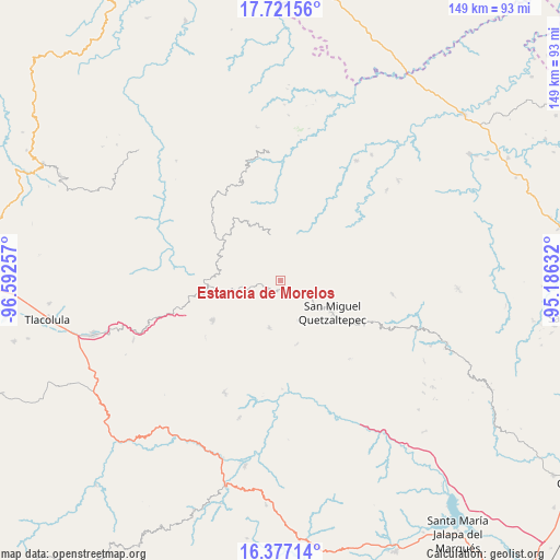
Estancia de Morelos GPS coordinates[2]
17° 3' 2.016" North, 95° 53' 21.984" West
| Map corner | latitude | longitude |
|---|---|---|
| Upper-left | 17.72156°, | -96.59257° |
| Center: | 17.05056°, | -95.88944° |
| Lower-right: | 16.37714°, | -95.18632° |
| Map W x H: | 149.5×149.5 km | = 92.9×92.9mi |
| max Lat: | 32.7° ⇑88.2% North |
| Estancia de Morelos: | 17.05056° |
| min Lat: | ⇓11.8% South 14.53588° |
| min Long | Estancia de Mor | max Long |
| -117.105° | -95.88944° | -86.73105° |
| W 82.5%⇐ | ⇒17.5% E |
Elevation
Elevation of Estancia de Morelos is 765 m = 2510 ft, and this is 488.7 m = 1603 ft below average elevation for this country.
| Max E: |
3497 m = 11473 ft | 63.8% |
| Avg. | 1253.7 m = 4113 ft | |
| Estancia de Morelos | 765 m = 2510 ft | |
Min E: |
-1 m = -3 ft | 36.2% |
See also: Mexico elevation on elevation.city.
Geographical zone
Estancia de Morelos is located in North Torrid zone (between Equator and Tropic of Cancer). Distance of this Northern Tropic circle is 710.1 km =441.2 mi to North.| Distance of | km | miles | from Estancia de Morelos |
|---|---|---|---|
| North Pole | 8111.2 | 5040.1 | to North |
| Arctic Circle | 5505.3 | 3420.8 | to North |
| Tropic Cancer | 710.1 | 441.2 | to North |
| Equator | 1895.8 | 1178 | to South |


Nearby cities:
15 places around Estancia de Morelos: (largest is in red/bold)
• Cacalotepec
7.3 km =4.5 mi,  256°
256°
• Cerro Moneda
5.2 km =3.2 mi,  217°
217°
• Guadalupe Victoria
15.5 km =9.6 mi,  277°
277°
• Las Peñas
15.8 km =9.8 mi,  247°
247°
• Linda Vista
11.7 km =7.3 mi, 254°
• San Juan Juquila
13.1 km =8.1 mi,  193°
193°
• San Juan Metaltepec
14.1 km =8.8 mi,  350°
350°
• San Pedro Ayacaxtepec
7.7 km =4.8 mi,  7°
7°
• San Pedro Ocotepec
11.6 km =7.2 mi,  156°
156°
• Santa Cruz Ocotal
10.4 km =6.5 mi,  137°
137°
• Santa María Alotepec
6 km =3.7 mi,  38°
38°
• Santa María Tepantlali
14 km =8.7 mi,  244°
244°
• Santiago Altitlán
8.5 km =5.3 mi,  314°
314°
• Santiago Zacatepec
12.5 km =7.8 mi, 347°
• Xambao (Colonia Revolución)
14.5 km =9 mi,  229°
229°
Sources, notices
• [Note1] Compared only with cities in Mexico existing in our database
• [Src1] Map data: © OpenStreetMap contributors (CC-BY-SA)
• [Src2] Other city data from geonames.org with taken over terms of usage.
• [Src3] Geographical zone / Annual Mean Temperature by Robert A. Rohde @ Wikipedia
