Santa María Alotepec geodata
Santa María Alotepec (Oaxaca) is a populated place; located in Mexico in America/Mexico_City (GMT-6) time zone. With population of 1,065 people, there are 8190 cities with bigger population in this country. Compared to other cities in Mexico, 87.8% of cities are located further ↑North; 82.6% of cities are located further ←West and 50.7% of cities have lower elevation than Santa María Alotepec. Note1


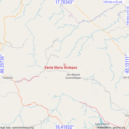
Santa María Alotepec GPS coordinates[2]
17° 5' 33.324" North, 95° 51' 15.228" West
| Map corner | latitude | longitude |
|---|---|---|
| Upper-left | 17.76343°, | -96.55736° |
| Center: | 17.09259°, | -95.85423° |
| Lower-right: | 16.41932°, | -95.15111° |
| Map W x H: | 149.5×149.5 km | = 92.9×92.9mi |
| max Lat: | 32.7° ⇑87.8% North |
| Santa María Alotepec: | 17.09259° |
| min Lat: | ⇓12.2% South 14.53588° |
| min Long | Santa María Al | max Long |
| -117.105° | -95.85423° | -86.73105° |
| W 82.6%⇐ | ⇒17.4% E |
Elevation
Elevation of Santa María Alotepec is 1473 m = 4833 ft, and this is 219.3 m = 719 ft above average elevation for this country.
| Max E: |
3497 m = 11473 ft | 49.3% |
| Santa María Alotepec | 1473 m 4833 ft | |
| Avg. | 1253.7 m = 4113 ft | |
Min E: |
-1 m = -3 ft | 50.7% |
See also: Mexico elevation on elevation.city.
Geographical zone
Santa María Alotepec is located in North Torrid zone (between Equator and Tropic of Cancer). Distance of this Northern Tropic circle is 705.4 km =438.3 mi to North.| Distance of | km | miles | from Santa María Alotepec |
|---|---|---|---|
| North Pole | 8106.5 | 5037.1 | to North |
| Arctic Circle | 5500.7 | 3418 | to North |
| Tropic Cancer | 705.4 | 438.3 | to North |
| Equator | 1900.5 | 1180.9 | to South |


Nearby cities:
15 places around Santa María Alotepec: (largest is in red/bold)
• Cacalotepec
12.6 km =7.8 mi,  239°
239°
• Cerro Moneda
11.2 km =7 mi,  217°
217°
• Estancia de Morelos
6 km =3.7 mi, 218°
• La Candelaria
16.3 km =10.1 mi,  329°
329°
• Linda Vista
17 km =10.6 mi, 242°
• San Francisco Jayacaxtepec
19.2 km =11.9 mi,  318°
318°
• San Juan Cotzocón
11 km =6.8 mi,  43°
43°
• San Juan Juquila
18.7 km =11.6 mi,  201°
201°
• San Juan Metaltepec
11.1 km =6.9 mi, 326°
• San Miguel Quetzaltepec
16.5 km =10.3 mi,  142°
142°
• San Pedro Ayacaxtepec
4 km =2.5 mi, 316°
• San Pedro Ocotepec
15.3 km =9.5 mi,  176°
176°
• Santa Cruz Ocotal
12.8 km =8 mi,  165°
165°
• Santiago Altitlán
9.8 km =6.1 mi,  277°
277°
• Santiago Zacatepec
9.9 km =6.2 mi, 319°
Sources, notices
• [Note1] Compared only with cities in Mexico existing in our database
• [Src1] Map data: © OpenStreetMap contributors (CC-BY-SA)
• [Src2] Other city data from geonames.org with taken over terms of usage.
• [Src3] Geographical zone / Annual Mean Temperature by Robert A. Rohde @ Wikipedia
