Cerro Moneda geodata
Cerro Moneda (Oaxaca) is a populated place; located in Mexico in America/Mexico_City (GMT-6) time zone. With population of 546 people, there are 15582 cities with bigger population in this country. Compared to other cities in Mexico, 88.7% of cities are located further ↑North; 82.4% of cities are located further ←West and 50.2% of cities have higher elevation than Cerro Moneda. Note1


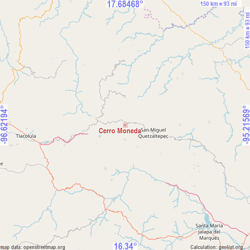
Cerro Moneda GPS coordinates[2]
17° 0' 48.78" North, 95° 55' 7.716" West
| Map corner | latitude | longitude |
|---|---|---|
| Upper-left | 17.68468°, | -96.62194° |
| Center: | 17.01355°, | -95.91881° |
| Lower-right: | 16.34°, | -95.21569° |
| Map W x H: | 149.5×149.5 km | = 92.9×92.9mi |
| max Lat: | 32.7° ⇑88.7% North |
| Cerro Moneda: | 17.01355° |
| min Lat: | ⇓11.3% South 14.53588° |
| min Long | Cerro Moneda | max Long |
| -117.105° | -95.91881° | -86.73105° |
| W 82.4%⇐ | ⇒17.6% E |
Elevation
Elevation of Cerro Moneda is 1421 m = 4662 ft, and this is 167.3 m = 549 ft above average elevation for this country.
| Max E: |
3497 m = 11473 ft | 50.2% |
| Cerro Moneda | 1421 m 4662 ft | |
| Avg. | 1253.7 m = 4113 ft | |
Min E: |
-1 m = -3 ft | 49.8% |
See also: Mexico elevation on elevation.city.
Geographical zone
Cerro Moneda is located in North Torrid zone (between Equator and Tropic of Cancer). Distance of this Northern Tropic circle is 714.2 km =443.8 mi to North.| Distance of | km | miles | from Cerro Moneda |
|---|---|---|---|
| North Pole | 8115.3 | 5042.6 | to North |
| Arctic Circle | 5509.4 | 3423.4 | to North |
| Tropic Cancer | 714.2 | 443.8 | to North |
| Equator | 1891.7 | 1175.4 | to South |


Nearby cities:
15 places around Cerro Moneda: (largest is in red/bold)
• Asunción Acatlán
13.5 km =8.4 mi,  194°
194°
• Cacalotepec
4.7 km =2.9 mi,  301°
301°
• Estancia de Morelos
5.2 km =3.2 mi,  37°
37°
• Guadalupe Victoria
13.8 km =8.6 mi, 297°
• Las Peñas
11.6 km =7.2 mi,  261°
261°
• Linda Vista
8.2 km =5.1 mi,  276°
276°
• San Juan Juquila
8.6 km =5.3 mi,  180°
180°
• San Pedro Ayacaxtepec
12.4 km =7.7 mi,  19°
19°
• San Pedro Ocotepec
10.1 km =6.3 mi,  129°
129°
• Santa Cruz Ocotal
10.8 km =6.7 mi,  109°
109°
• Santa María Alotepec
11.2 km =7 mi, 37°
• Santa María Tepantlali
9.8 km =6.1 mi, 258°
• Santiago Altitlán
10.5 km =6.5 mi,  344°
344°
• Tierra Blanca
13.7 km =8.5 mi, 276°
• Xambao (Colonia Revolución)
9.5 km =5.9 mi,  235°
235°
Sources, notices
• [Note1] Compared only with cities in Mexico existing in our database
• [Src1] Map data: © OpenStreetMap contributors (CC-BY-SA)
• [Src2] Other city data from geonames.org with taken over terms of usage.
• [Src3] Geographical zone / Annual Mean Temperature by Robert A. Rohde @ Wikipedia
