San Martín Zacatempa geodata
San Martín Zacatempa (Puebla) is a populated place; located in Mexico in America/Mexico_City (GMT-6) time zone. With population of 721 people, there are 12102 cities with bigger population in this country. Compared to other cities in Mexico, 67.3% of cities are located further ↑North; 56% of cities are located further ←West and 84.7% of cities have lower elevation than San Martín Zacatempa. Note1


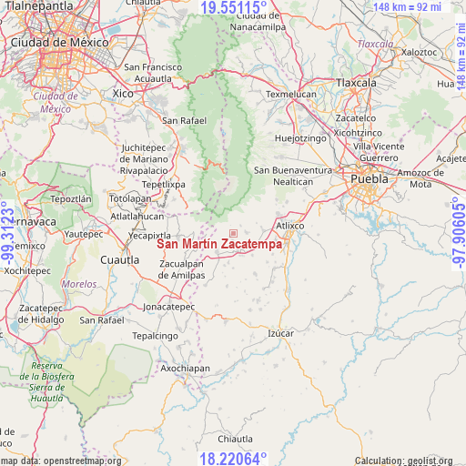
San Martín Zacatempa GPS coordinates[2]
18° 53' 13.992" North, 98° 36' 33.012" West
| Map corner | latitude | longitude |
|---|---|---|
| Upper-left | 19.55115°, | -99.3123° |
| Center: | 18.88722°, | -98.60917° |
| Lower-right: | 18.22064°, | -97.90605° |
| Map W x H: | 147.9×147.9 km | = 91.9×91.9mi |
| max Lat: | 32.7° ⇑67.3% North |
| San Martín Zacatempa: | 18.88722° |
| min Lat: | ⇓32.7% South 14.53588° |
| min Long | San Martín Zac | max Long |
| -117.105° | -98.60917° | -86.73105° |
| W 56%⇐ | ⇒44% E |
Elevation
Elevation of San Martín Zacatempa is 2255 m = 7398 ft, and this is 1001.3 m = 3285 ft above average elevation for this country.
| Max E: |
3497 m = 11473 ft | 15.3% |
| San Martín Zacatempa | 2255 m 7398 ft | |
| Avg. | 1253.7 m = 4113 ft | |
Min E: |
-1 m = -3 ft | 84.7% |
See also: Mexico elevation on elevation.city.
Geographical zone
San Martín Zacatempa is located in North Torrid zone (between Equator and Tropic of Cancer). Distance of this Northern Tropic circle is 505.9 km =314.4 mi to North.| Distance of | km | miles | from San Martín Zacatempa |
|---|---|---|---|
| North Pole | 7907 | 4913.2 | to North |
| Arctic Circle | 5301.1 | 3293.9 | to North |
| Tropic Cancer | 505.9 | 314.4 | to North |
| Equator | 2100.1 | 1304.9 | to South |


Nearby cities:
15 places around San Martín Zacatempa: (largest is in red/bold)
• Colonia Agrícola de Ocotepec (Colonia San José)
8.3 km =5.2 mi,  55°
55°
• Hueyapan
7.7 km =4.8 mi,  272°
272°
• Huilango
5.6 km =3.5 mi,  149°
149°
• Jerusalén
2.9 km =1.8 mi, 58°
• La Magdalena Yancuitlalpan
3.3 km =2.1 mi,  38°
38°
• San Juan Amecac
7.9 km =4.9 mi,  221°
221°
• San Juan Ocotepec
8.4 km =5.2 mi,  50°
50°
• San Juan Tejupa
8 km =5 mi,  116°
116°
• Santa Catalina Tepanapa
0.5 km =0.3 mi,  340°
340°
• Santa Cruz Cuautomatitla
5.3 km =3.3 mi, 272°
• Santiago Atzitzihuacán
7.5 km =4.7 mi,  157°
157°
• Santiago Tochimizolco
2.2 km =1.4 mi,  183°
183°
• Tecuanipa
1.2 km =0.7 mi,  236°
236°
• Tochimilco
4 km =2.5 mi,  84°
84°
• Tulcingo
5.7 km =3.5 mi,  165°
165°
Sources, notices
• [Note1] Compared only with cities in Mexico existing in our database
• [Src1] Map data: © OpenStreetMap contributors (CC-BY-SA)
• [Src2] Other city data from geonames.org with taken over terms of usage.
• [Src3] Geographical zone / Annual Mean Temperature by Robert A. Rohde @ Wikipedia
