Hueyapan geodata
Hueyapan (Morelos) is a populated place; located in Mexico in America/Mexico_City (GMT-6) time zone. With population of 6,478 people, there are 1448 cities with bigger population in this country. Compared to other cities in Mexico, 67.2% of cities are located further ↑North; 55.3% of cities are located further ←West and 88.6% of cities have lower elevation than Hueyapan. Note1


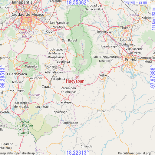
Hueyapan GPS coordinates[2]
18° 53' 22.92" North, 98° 40' 55.2" West
| Map corner | latitude | longitude |
|---|---|---|
| Upper-left | 19.55362°, | -99.38513° |
| Center: | 18.8897°, | -98.682° |
| Lower-right: | 18.22313°, | -97.97888° |
| Map W x H: | 147.9×147.9 km | = 91.9×91.9mi |
| max Lat: | 32.7° ⇑67.2% North |
| Hueyapan: | 18.8897° |
| min Lat: | ⇓32.8% South 14.53588° |
| min Long | Hueyapan | max Long |
| -117.105° | -98.682° | -86.73105° |
| W 55.3%⇐ | ⇒44.7% E |
Elevation
Elevation of Hueyapan is 2360 m = 7743 ft, and this is 1106.3 m = 3630 ft above average elevation for this country.
| Max E: |
3497 m = 11473 ft | 11.4% |
| Hueyapan | 2360 m 7743 ft | |
| Avg. | 1253.7 m = 4113 ft | |
Min E: |
-1 m = -3 ft | 88.6% |
See also: Mexico elevation on elevation.city.
Geographical zone
Hueyapan is located in North Torrid zone (between Equator and Tropic of Cancer). Distance of this Northern Tropic circle is 505.6 km =314.2 mi to North.| Distance of | km | miles | from Hueyapan |
|---|---|---|---|
| North Pole | 7906.7 | 4913 | to North |
| Arctic Circle | 5300.8 | 3293.8 | to North |
| Tropic Cancer | 505.6 | 314.2 | to North |
| Equator | 2100.3 | 1305.1 | to South |


Nearby cities:
15 places around Hueyapan: (largest is in red/bold)
• Huejotengo (San Marcos)
7.7 km =4.8 mi,  277°
277°
• Huepalcalco (San Miguel)
7.5 km =4.7 mi,  286°
286°
• Metepec
6.9 km =4.3 mi,  259°
259°
• Ocoxaltepec
9 km =5.6 mi,  304°
304°
• San Antonio Alpanocan
3.3 km =2.1 mi,  245°
245°
• San Felipe Cuapexco
8 km =5 mi,  197°
197°
• San Francisco Tepango
6.2 km =3.9 mi, 199°
• San Juan Amecac
6.6 km =4.1 mi,  158°
158°
• San Martín Zacatempa
7.7 km =4.8 mi,  92°
92°
• San Mateo Coatepec
9.1 km =5.7 mi, 161°
• Santa Catalina Tepanapa
7.5 km =4.7 mi, 88°
• Santa Cruz Cuautomatitla
2.4 km =1.5 mi, 91°
• Santiago Tochimizolco
7.9 km =4.9 mi,  108°
108°
• Tecuanipa
6.7 km =4.2 mi,  98°
98°
• Tetela del Volcán
5 km =3.1 mi,  274°
274°
Sources, notices
• [Note1] Compared only with cities in Mexico existing in our database
• [Src1] Map data: © OpenStreetMap contributors (CC-BY-SA)
• [Src2] Other city data from geonames.org with taken over terms of usage.
• [Src3] Geographical zone / Annual Mean Temperature by Robert A. Rohde @ Wikipedia
