Santa Cruz Cuautomatitla geodata
Santa Cruz Cuautomatitla (Puebla) is a populated place; located in Mexico in America/Mexico_City (GMT-6) time zone. With population of 1,405 people, there are 6164 cities with bigger population in this country. Compared to other cities in Mexico, 67.3% of cities are located further ↑North; 55.5% of cities are located further ←West and 92.8% of cities have lower elevation than Santa Cruz Cuautomatitla. Note1
Current local time in Santa Cruz Cuautomatitla:
11:21 AM, MondayDifference from your time zone: hours


Santa Cruz Cuautomatitla GPS coordinates[2]
18° 53' 21.012" North, 98° 39' 33.012" West
| Map corner | latitude | longitude |
|---|---|---|
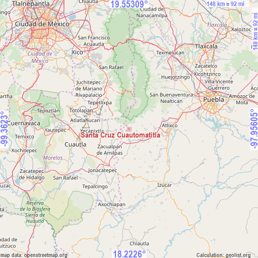
| Upper-left | 19.55309°, | -99.3623° |
| Center: | 18.88917°, | -98.65917° |
| Lower-right: | 18.2226°, | -97.95605° |
| Map W x H: | 147.9×147.9 km | = 91.9×91.9mi |
| max Lat: | 32.7° ⇑67.3% North |
| Santa Cruz Cuautomatitla: | 18.88917° |
| min Lat: | ⇓32.7% South 14.53588° |
| min Long | Santa Cruz Cuau | max Long |
| -117.105° | -98.65917° | -86.73105° |
| W 55.5%⇐ | ⇒44.5% E |
Elevation
Elevation of Santa Cruz Cuautomatitla is 2519 m = 8264 ft, and this is 1265.3 m = 4151 ft above average elevation for this country.
| Max E: |
3497 m = 11473 ft | 7.2% |
| Santa Cruz Cuautomatitla | 2519 m 8264 ft | |
| Avg. | 1253.7 m = 4113 ft | |
Min E: |
-1 m = -3 ft | 92.8% |
See also: Mexico elevation on elevation.city.
Geographical zone
Santa Cruz Cuautomatitla is located in North Torrid zone (between Equator and Tropic of Cancer). Distance of this Northern Tropic circle is 505.6 km =314.2 mi to North.| Distance of | km | miles | from Santa Cruz Cuautomatitla |
|---|---|---|---|
| North Pole | 7906.8 | 4913.1 | to North |
| Arctic Circle | 5300.9 | 3293.8 | to North |
| Tropic Cancer | 505.6 | 314.2 | to North |
| Equator | 2100.3 | 1305.1 | to South |


Nearby cities:
15 places around Santa Cruz Cuautomatitla: (largest is in red/bold)
• Hueyapan
2.4 km =1.5 mi,  271°
271°
• Jerusalén
7.8 km =4.8 mi,  80°
80°
• La Magdalena Yancuitlalpan
7.7 km =4.8 mi,  71°
71°
• San Antonio Alpanocan
5.6 km =3.5 mi,  256°
256°
• San Felipe Cuapexco
9 km =5.6 mi,  212°
212°
• San Francisco Tepango
7.4 km =4.6 mi,  217°
217°
• San Juan Amecac
6.1 km =3.8 mi,  179°
179°
• San Martín Zacatempa
5.3 km =3.3 mi,  92°
92°
• San Mateo Coatepec
8.6 km =5.3 mi, 176°
• Santa Catalina Tepanapa
5.1 km =3.2 mi, 86°
• Santiago Tochimizolco
5.7 km =3.5 mi,  115°
115°
• Tecuanipa
4.3 km =2.7 mi,  101°
101°
• Tetela del Volcán
7.4 km =4.6 mi, 273°
• Tochimilco
9.2 km =5.7 mi, 88°
• Tulcingo
8.8 km =5.5 mi,  130°
130°
Sources, notices
• [Note1] Compared only with cities in Mexico existing in our database
• [Src1] Map data: © OpenStreetMap contributors (CC-BY-SA)
• [Src2] Other city data from geonames.org with taken over terms of usage.
• [Src3] Geographical zone / Annual Mean Temperature by Robert A. Rohde @ Wikipedia
