San Lucas geodata
San Lucas (State of Mexico) is a populated place; located in Mexico in America/Mexico_City (GMT-6) time zone. With population of 1,098 people, there are 7922 cities with bigger population in this country. Compared to other cities in Mexico, 59.7% of cities are located further ↑North; 64.1% of cities are located further →East and 89.3% of cities have lower elevation than San Lucas. Note1


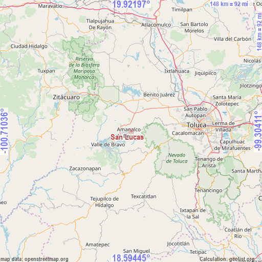
San Lucas GPS coordinates[2]
19° 15' 34.38" North, 100° 0' 26.028" West
| Map corner | latitude | longitude |
|---|---|---|
| Upper-left | 19.92197°, | -100.71036° |
| Center: | 19.25955°, | -100.00723° |
| Lower-right: | 18.59445°, | -99.30411° |
| Map W x H: | 147.6×147.6 km | = 91.7×91.7mi |
| max Lat: | 32.7° ⇑59.7% North |
| San Lucas: | 19.25955° |
| min Lat: | ⇓40.3% South 14.53588° |
| min Long | San Lucas | max Long |
| -117.105° | -100.00723° | -86.73105° |
| W 35.9%⇐ | ⇒64.1% E |
Elevation
Elevation of San Lucas is 2381 m = 7812 ft, and this is 1127.3 m = 3698 ft above average elevation for this country.
| Max E: |
3497 m = 11473 ft | 10.7% |
| San Lucas | 2381 m 7812 ft | |
| Avg. | 1253.7 m = 4113 ft | |
Min E: |
-1 m = -3 ft | 89.3% |
See also: Mexico elevation on elevation.city.
Geographical zone
San Lucas is located in North Torrid zone (between Equator and Tropic of Cancer). Distance of this Northern Tropic circle is 464.5 km =288.6 mi to North.| Distance of | km | miles | from San Lucas |
|---|---|---|---|
| North Pole | 7865.6 | 4887.5 | to North |
| Arctic Circle | 5259.7 | 3268.2 | to North |
| Tropic Cancer | 464.5 | 288.6 | to North |
| Equator | 2141.5 | 1330.7 | to South |


Nearby cities:
15 places around San Lucas: (largest is in red/bold)
• Agua Bendita
6.7 km =4.2 mi,  76°
76°
• Amanalco de Becerra
1.5 km =0.9 mi,  243°
243°
• Amanalco de Becerra
6.4 km =4 mi,  351°
351°
• El Capulín Primera Seccion
7.2 km =4.5 mi,  46°
46°
• El Potrero
5.4 km =3.4 mi,  15°
15°
• Pueblo Nuevo
4.1 km =2.5 mi,  328°
328°
• Rincón de Guadalupe
2 km =1.2 mi,  35°
35°
• Sabana de Taborda 1ra. Sección
7.9 km =4.9 mi,  3°
3°
• San Bartolo
5.1 km =3.2 mi,  251°
251°
• San Jerónimo
2.5 km =1.6 mi,  219°
219°
• San Juan
2.8 km =1.7 mi, 239°
• San Mateo
2.4 km =1.5 mi,  339°
339°
• San Miguel (San Miguel Tenextepec)
2.4 km =1.5 mi,  280°
280°
• San Sebastián el Chico
1.7 km =1.1 mi,  301°
301°
• San Sebastián el Grande
6.6 km =4.1 mi,  308°
308°
Sources, notices
• [Note1] Compared only with cities in Mexico existing in our database
• [Src1] Map data: © OpenStreetMap contributors (CC-BY-SA)
• [Src2] Other city data from geonames.org with taken over terms of usage.
• [Src3] Geographical zone / Annual Mean Temperature by Robert A. Rohde @ Wikipedia
