San Juan Ixtayopan geodata
San Juan Ixtayopan (Mexico City) is a populated place; located in Mexico in America/Mexico_City (GMT-6) time zone. With population of 24,120 people, there are 422 cities with bigger population in this country. Compared to other cities in Mexico, 60.3% of cities are located further ↑North; 50.2% of cities are located further ←West and 85.7% of cities have lower elevation than San Juan Ixtayopan. Note1


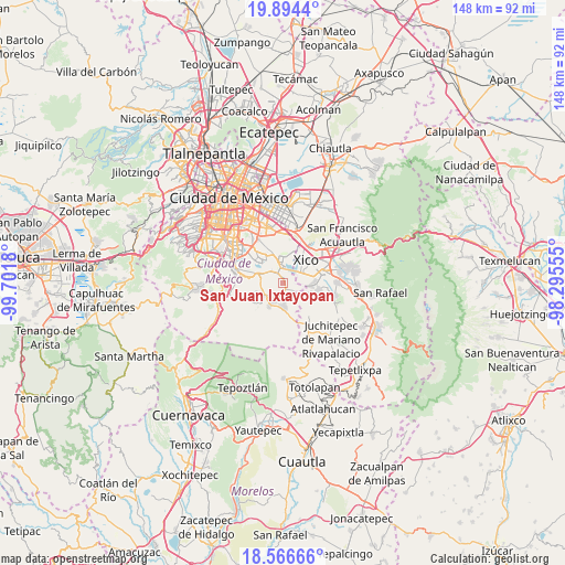
San Juan Ixtayopan GPS coordinates[2]
19° 13' 54.732" North, 98° 59' 55.212" West
| Map corner | latitude | longitude |
|---|---|---|
| Upper-left | 19.8944°, | -99.7018° |
| Center: | 19.23187°, | -98.99867° |
| Lower-right: | 18.56666°, | -98.29555° |
| Map W x H: | 147.6×147.6 km | = 91.7×91.7mi |
| max Lat: | 32.7° ⇑60.3% North |
| San Juan Ixtayopan: | 19.23187° |
| min Lat: | ⇓39.7% South 14.53588° |
| min Long | San Juan Ixtayo | max Long |
| -117.105° | -98.99867° | -86.73105° |
| W 50.2%⇐ | ⇒49.8% E |
Elevation
Elevation of San Juan Ixtayopan is 2274 m = 7461 ft, and this is 1020.3 m = 3347 ft above average elevation for this country.
| Max E: |
3497 m = 11473 ft | 14.3% |
| San Juan Ixtayopan | 2274 m 7461 ft | |
| Avg. | 1253.7 m = 4113 ft | |
Min E: |
-1 m = -3 ft | 85.7% |
See also: Mexico elevation on elevation.city.
Geographical zone
San Juan Ixtayopan is located in North Torrid zone (between Equator and Tropic of Cancer). Distance of this Northern Tropic circle is 467.5 km =290.5 mi to North.| Distance of | km | miles | from San Juan Ixtayopan |
|---|---|---|---|
| North Pole | 7868.7 | 4889.4 | to North |
| Arctic Circle | 5262.8 | 3270.2 | to North |
| Tropic Cancer | 467.5 | 290.5 | to North |
| Equator | 2138.4 | 1328.7 | to South |


Nearby cities:
15 places around San Juan Ixtayopan: (largest is in red/bold)
• Barrio de Guadalupe
7.1 km =4.4 mi,  91°
91°
• Caserío de Cortés
5.9 km =3.7 mi,  128°
128°
• Milpa Alta
5.1 km =3.2 mi,  210°
210°
• San Andrés Mixquic
3.7 km =2.3 mi,  101°
101°
• San Antonio Tecómitl
1.9 km =1.2 mi,  144°
144°
• San Francisco Tecoxpa
4.5 km =2.8 mi,  190°
190°
• San Ignacio de Loyola
4.7 km =2.9 mi,  111°
111°
• San Isidro Cuatepec
1.7 km =1.1 mi, 213°
• San Juan y San Pedro Tezompa
4.9 km =3 mi,  124°
124°
• San Lorenzo Tlacoyucan
7.1 km =4.4 mi, 209°
• San Pedro Atocpan
6.3 km =3.9 mi,  237°
237°
• Santa Ana Tlacotenco
6.2 km =3.9 mi,  179°
179°
• Tetelco
3.2 km =2 mi, 121°
• Tláhuac
6.2 km =3.9 mi,  353°
353°
• Xico
6.6 km =4.1 mi,  49°
49°
Sources, notices
• [Note1] Compared only with cities in Mexico existing in our database
• [Src1] Map data: © OpenStreetMap contributors (CC-BY-SA)
• [Src2] Other city data from geonames.org with taken over terms of usage.
• [Src3] Geographical zone / Annual Mean Temperature by Robert A. Rohde @ Wikipedia
