San Lorenzo Tlacoyucan geodata
San Lorenzo Tlacoyucan (Mexico City) is a populated place; located in Mexico in America/Mexico_City (GMT-6) time zone. With population of 3,676 people, there are 2498 cities with bigger population in this country. Compared to other cities in Mexico, 61.7% of cities are located further ↑North; 50.3% of cities are located further →East and 96% of cities have lower elevation than San Lorenzo Tlacoyucan. Note1


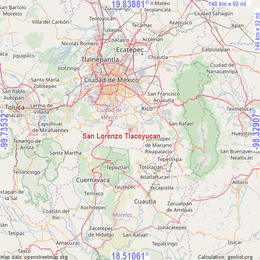
San Lorenzo Tlacoyucan GPS coordinates[2]
19° 10' 33.78" North, 99° 1' 55.884" West
| Map corner | latitude | longitude |
|---|---|---|
| Upper-left | 19.83881°, | -99.73532° |
| Center: | 19.17605°, | -99.03219° |
| Lower-right: | 18.51061°, | -98.32907° |
| Map W x H: | 147.7×147.7 km | = 91.8×91.8mi |
| max Lat: | 32.7° ⇑61.7% North |
| San Lorenzo Tlacoyucan: | 19.17605° |
| min Lat: | ⇓38.3% South 14.53588° |
| min Long | San Lorenzo Tla | max Long |
| -117.105° | -99.03219° | -86.73105° |
| W 49.7%⇐ | ⇒50.3% E |
Elevation
Elevation of San Lorenzo Tlacoyucan is 2626 m = 8615 ft, and this is 1372.3 m = 4502 ft above average elevation for this country.
| Max E: |
3497 m = 11473 ft | 4% |
| San Lorenzo Tlacoyucan | 2626 m 8615 ft | |
| Avg. | 1253.7 m = 4113 ft | |
Min E: |
-1 m = -3 ft | 96% |
See also: Mexico elevation on elevation.city.
Geographical zone
San Lorenzo Tlacoyucan is located in North Torrid zone (between Equator and Tropic of Cancer). Distance of this Northern Tropic circle is 473.7 km =294.3 mi to North.| Distance of | km | miles | from San Lorenzo Tlacoyucan |
|---|---|---|---|
| North Pole | 7874.9 | 4893.2 | to North |
| Arctic Circle | 5269 | 3274 | to North |
| Tropic Cancer | 473.7 | 294.3 | to North |
| Equator | 2132.2 | 1324.9 | to South |


Nearby cities:
15 places around San Lorenzo Tlacoyucan: (largest is in red/bold)
• Caserío de Cortés
8.5 km =5.3 mi,  72°
72°
• Milpa Alta
2.1 km =1.3 mi,  27°
27°
• San Andrés Mixquic
9 km =5.6 mi,  52°
52°
• San Antonio Tecómitl
6.6 km =4.1 mi,  44°
44°
• San Bartolome Xicomulco
5 km =3.1 mi,  311°
311°
• San Francisco Tecoxpa
3.2 km =2 mi,  57°
57°
• San Ignacio de Loyola
9.1 km =5.7 mi, 60°
• San Isidro Cuatepec
5.4 km =3.4 mi, 28°
• San Juan Ixtayopan
7.1 km =4.4 mi, 29°
• San Juan y San Pedro Tezompa
8.2 km =5.1 mi, 65°
• San Pablo Oztotepec
4.5 km =2.8 mi,  284°
284°
• San Pedro Atocpan
3.4 km =2.1 mi,  327°
327°
• San Salvador Cuauhtenco
6.3 km =3.9 mi,  287°
287°
• Santa Ana Tlacotenco
3.6 km =2.2 mi,  90°
90°
• Tetelco
7.7 km =4.8 mi, 53°
Sources, notices
• [Note1] Compared only with cities in Mexico existing in our database
• [Src1] Map data: © OpenStreetMap contributors (CC-BY-SA)
• [Src2] Other city data from geonames.org with taken over terms of usage.
• [Src3] Geographical zone / Annual Mean Temperature by Robert A. Rohde @ Wikipedia
