San Isidro Cuatepec geodata
San Isidro Cuatepec (Mexico City) is a populated place; located in Mexico in America/Mexico_City (GMT-6) time zone. With population of 670 people, there are 12949 cities with bigger population in this country. Compared to other cities in Mexico, 60.7% of cities are located further ↑North; 50% of cities are located further ←West and 89% of cities have lower elevation than San Isidro Cuatepec. Note1


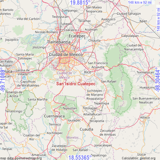
San Isidro Cuatepec GPS coordinates[2]
19° 13' 8.112" North, 99° 0' 27.936" West
| Map corner | latitude | longitude |
|---|---|---|
| Upper-left | 19.8815°, | -99.71089° |
| Center: | 19.21892°, | -99.00776° |
| Lower-right: | 18.55365°, | -98.30464° |
| Map W x H: | 147.6×147.6 km | = 91.7×91.7mi |
| max Lat: | 32.7° ⇑60.7% North |
| San Isidro Cuatepec: | 19.21892° |
| min Lat: | ⇓39.3% South 14.53588° |
| min Long | San Isidro Cuat | max Long |
| -117.105° | -99.00776° | -86.73105° |
| W 50%⇐ | ⇒50% E |
Elevation
Elevation of San Isidro Cuatepec is 2374 m = 7789 ft, and this is 1120.3 m = 3676 ft above average elevation for this country.
| Max E: |
3497 m = 11473 ft | 11% |
| San Isidro Cuatepec | 2374 m 7789 ft | |
| Avg. | 1253.7 m = 4113 ft | |
Min E: |
-1 m = -3 ft | 89% |
See also: Mexico elevation on elevation.city.
Geographical zone
San Isidro Cuatepec is located in North Torrid zone (between Equator and Tropic of Cancer). Distance of this Northern Tropic circle is 469 km =291.4 mi to North.| Distance of | km | miles | from San Isidro Cuatepec |
|---|---|---|---|
| North Pole | 7870.1 | 4890.3 | to North |
| Arctic Circle | 5264.2 | 3271 | to North |
| Tropic Cancer | 469 | 291.4 | to North |
| Equator | 2136.9 | 1327.8 | to South |


Nearby cities:
15 places around San Isidro Cuatepec: (largest is in red/bold)
• Caserío de Cortés
6 km =3.7 mi,  111°
111°
• Milpa Alta
3.4 km =2.1 mi,  208°
208°
• San Andrés Mixquic
4.6 km =2.9 mi,  81°
81°
• San Antonio Tecómitl
2.1 km =1.3 mi,  93°
93°
• San Bartolome Xicomulco
6.5 km =4 mi,  257°
257°
• San Francisco Tecoxpa
3 km =1.9 mi,  177°
177°
• San Ignacio de Loyola
5.3 km =3.3 mi, 93°
• San Juan Ixtayopan
1.7 km =1.1 mi,  33°
33°
• San Juan y San Pedro Tezompa
5.1 km =3.2 mi, 105°
• San Lorenzo Tlacoyucan
5.4 km =3.4 mi, 208°
• San Pablo Oztotepec
7.8 km =4.8 mi,  242°
242°
• San Pedro Atocpan
4.8 km =3 mi,  246°
246°
• Santa Ana Tlacotenco
4.9 km =3 mi,  167°
167°
• Tetelco
3.7 km =2.3 mi, 93°
• Tláhuac
7.6 km =4.7 mi,  2°
2°
Sources, notices
• [Note1] Compared only with cities in Mexico existing in our database
• [Src1] Map data: © OpenStreetMap contributors (CC-BY-SA)
• [Src2] Other city data from geonames.org with taken over terms of usage.
• [Src3] Geographical zone / Annual Mean Temperature by Robert A. Rohde @ Wikipedia
