San Juan Chilateca geodata
San Juan Chilateca (Oaxaca) is a seat of a second-order administrative division; located in Mexico in America/Mexico_City (GMT-6) time zone. With population of 1,442 people, there are 5987 cities with bigger population in this country. Compared to other cities in Mexico, 91.3% of cities are located further ↑North; 78.7% of cities are located further ←West and 51.7% of cities have lower elevation than San Juan Chilateca. Note1


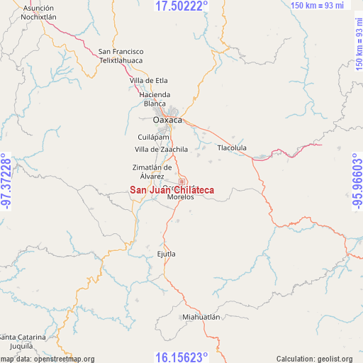
San Juan Chilateca GPS coordinates[2]
16° 49' 49.512" North, 96° 40' 8.94" West
| Map corner | latitude | longitude |
|---|---|---|
| Upper-left | 17.50222°, | -97.37228° |
| Center: | 16.83042°, | -96.66915° |
| Lower-right: | 16.15623°, | -95.96603° |
| Map W x H: | 149.7×149.7 km | = 93×93mi |
| max Lat: | 32.7° ⇑91.3% North |
| San Juan Chilateca: | 16.83042° |
| min Lat: | ⇓8.7% South 14.53588° |
| min Long | San Juan Chilat | max Long |
| -117.105° | -96.66915° | -86.73105° |
| W 78.7%⇐ | ⇒21.3% E |
Elevation
Elevation of San Juan Chilateca is 1512 m = 4961 ft, and this is 258.3 m = 847 ft above average elevation for this country.
| Max E: |
3497 m = 11473 ft | 48.3% |
| San Juan Chilateca | 1512 m 4961 ft | |
| Avg. | 1253.7 m = 4113 ft | |
Min E: |
-1 m = -3 ft | 51.7% |
See also: Mexico elevation on elevation.city.
Geographical zone
San Juan Chilateca is located in North Torrid zone (between Equator and Tropic of Cancer). Distance of this Northern Tropic circle is 734.6 km =456.5 mi to North.| Distance of | km | miles | from San Juan Chilateca |
|---|---|---|---|
| North Pole | 8135.7 | 5055.3 | to North |
| Arctic Circle | 5529.8 | 3436.1 | to North |
| Tropic Cancer | 734.6 | 456.5 | to North |
| Equator | 1871.4 | 1162.8 | to South |


Nearby cities:
15 places around San Juan Chilateca: (largest is in red/bold)
• Asunción Ocotlán
9.4 km =5.8 mi,  216°
216°
• Ocotlán de Morelos
4.4 km =2.7 mi,  187°
187°
• San Antonino Castillo Velasco
3.5 km =2.2 mi,  204°
204°
• San Dionisio Ocotlán
9.3 km =5.8 mi, 187°
• San Jacinto Chilateca
2 km =1.2 mi,  303°
303°
• San Jerónimo Zegache
8.9 km =5.5 mi,  284°
284°
• San Martín Tilcajete
4.3 km =2.7 mi,  320°
320°
• San Pedro Guegorexe
4.6 km =2.9 mi,  356°
356°
• Santa Ana Zegache
6.5 km =4 mi, 276°
• Santa Catarina Minas
8 km =5 mi,  134°
134°
• Santa Catarina Quiané
9.6 km =6 mi,  307°
307°
• Santa Cecilia Jalieza
8.2 km =5.1 mi,  43°
43°
• Santiago Apostol
6.2 km =3.9 mi,  241°
241°
• Santo Domingo Jalieza
6 km =3.7 mi,  45°
45°
• Santo Tomás Jalieza
1.6 km =1 mi,  354°
354°
Sources, notices
• [Note1] Compared only with cities in Mexico existing in our database
• [Src1] Map data: © OpenStreetMap contributors (CC-BY-SA)
• [Src2] Other city data from geonames.org with taken over terms of usage.
• [Src3] Geographical zone / Annual Mean Temperature by Robert A. Rohde @ Wikipedia
