San Dionisio Ocotlán geodata
San Dionisio Ocotlán (Oaxaca) is a populated place; located in Mexico in America/Mexico_City (GMT-6) time zone. With population of 1,007 people, there are 8660 cities with bigger population in this country. Compared to other cities in Mexico, 92.3% of cities are located further ↑North; 78.6% of cities are located further ←West and 51.9% of cities have lower elevation than San Dionisio Ocotlán. Note1


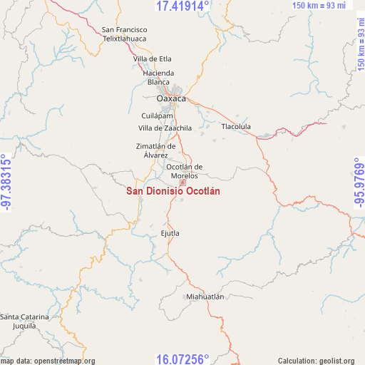
San Dionisio Ocotlán GPS coordinates[2]
16° 44' 49.344" North, 96° 40' 48.072" West
| Map corner | latitude | longitude |
|---|---|---|
| Upper-left | 17.41914°, | -97.38315° |
| Center: | 16.74704°, | -96.68002° |
| Lower-right: | 16.07256°, | -95.9769° |
| Map W x H: | 149.7×149.7 km | = 93×93mi |
| max Lat: | 32.7° ⇑92.3% North |
| San Dionisio Ocotlán: | 16.74704° |
| min Lat: | ⇓7.7% South 14.53588° |
| min Long | San Dionisio Oc | max Long |
| -117.105° | -96.68002° | -86.73105° |
| W 78.6%⇐ | ⇒21.4% E |
Elevation
Elevation of San Dionisio Ocotlán is 1521 m = 4990 ft, and this is 267.3 m = 877 ft above average elevation for this country.
| Max E: |
3497 m = 11473 ft | 48.1% |
| San Dionisio Ocotlán | 1521 m 4990 ft | |
| Avg. | 1253.7 m = 4113 ft | |
Min E: |
-1 m = -3 ft | 51.9% |
See also: Mexico elevation on elevation.city.
Geographical zone
San Dionisio Ocotlán is located in North Torrid zone (between Equator and Tropic of Cancer). Distance of this Northern Tropic circle is 743.8 km =462.2 mi to North.| Distance of | km | miles | from San Dionisio Ocotlán |
|---|---|---|---|
| North Pole | 8145 | 5061.1 | to North |
| Arctic Circle | 5539.1 | 3441.8 | to North |
| Tropic Cancer | 743.8 | 462.2 | to North |
| Equator | 1862.1 | 1157.1 | to South |


Nearby cities:
15 places around San Dionisio Ocotlán: (largest is in red/bold)
• Asunción Ocotlán
4.7 km =2.9 mi,  290°
290°
• Magdalena Ocotlán
5.3 km =3.3 mi,  216°
216°
• Maguey Largo
7.5 km =4.7 mi,  160°
160°
• Ocotlán de Morelos
5 km =3.1 mi,  6°
6°
• Praxedis de Guerrero
5.2 km =3.2 mi,  125°
125°
• San Antonino Castillo Velasco
6.1 km =3.8 mi,  357°
357°
• San José del Progreso
6.7 km =4.2 mi,  184°
184°
• San José la Garzona
8.6 km =5.3 mi,  149°
149°
• San Juan Chilateca
9.3 km =5.8 mi, 7°
• San Pedro Apóstol
4.9 km =3 mi,  256°
256°
• San Pedro Martir
3.3 km =2.1 mi, 262°
• Santa Catarina Minas
7.8 km =4.8 mi,  62°
62°
• Santa Lucía Ocotlán
1 km =0.6 mi, 177°
• Santiago Apostol
7.6 km =4.7 mi,  325°
325°
• Tejas de Morelos
9.6 km =6 mi,  278°
278°
Sources, notices
• [Note1] Compared only with cities in Mexico existing in our database
• [Src1] Map data: © OpenStreetMap contributors (CC-BY-SA)
• [Src2] Other city data from geonames.org with taken over terms of usage.
• [Src3] Geographical zone / Annual Mean Temperature by Robert A. Rohde @ Wikipedia
