San Jerónimo Zegache geodata
San Jerónimo Zegache (Oaxaca) is a populated place; located in Mexico in America/Mexico_City (GMT-6) time zone. With population of 536 people, there are 15820 cities with bigger population in this country. Compared to other cities in Mexico, 91% of cities are located further ↑North; 77.9% of cities are located further ←West and 51.2% of cities have lower elevation than San Jerónimo Zegache. Note1


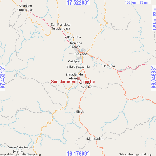
San Jerónimo Zegache GPS coordinates[2]
16° 51' 3.996" North, 96° 45' 0" West
| Map corner | latitude | longitude |
|---|---|---|
| Upper-left | 17.52283°, | -97.45313° |
| Center: | 16.85111°, | -96.75° |
| Lower-right: | 16.17699°, | -96.04688° |
| Map W x H: | 149.6×149.6 km | = 93×93mi |
| max Lat: | 32.7° ⇑91% North |
| San Jerónimo Zegache: | 16.85111° |
| min Lat: | ⇓9% South 14.53588° |
| min Long | San Jerónimo Z | max Long |
| -117.105° | -96.75° | -86.73105° |
| W 77.9%⇐ | ⇒22.1% E |
Elevation
Elevation of San Jerónimo Zegache is 1494 m = 4902 ft, and this is 240.3 m = 788 ft above average elevation for this country.
| Max E: |
3497 m = 11473 ft | 48.8% |
| San Jerónimo Zegache | 1494 m 4902 ft | |
| Avg. | 1253.7 m = 4113 ft | |
Min E: |
-1 m = -3 ft | 51.2% |
See also: Mexico elevation on elevation.city.
Geographical zone
San Jerónimo Zegache is located in North Torrid zone (between Equator and Tropic of Cancer). Distance of this Northern Tropic circle is 732.3 km =455 mi to North.| Distance of | km | miles | from San Jerónimo Zegache |
|---|---|---|---|
| North Pole | 8133.4 | 5053.9 | to North |
| Arctic Circle | 5527.5 | 3434.6 | to North |
| Tropic Cancer | 732.3 | 455 | to North |
| Equator | 1873.7 | 1164.3 | to South |


Nearby cities:
15 places around San Jerónimo Zegache: (largest is in red/bold)
• Ciénega de Zimatlán
5.1 km =3.2 mi,  338°
338°
• Reyes Mantecón
6.7 km =4.2 mi,  21°
21°
• San Jacinto Chilateca
7 km =4.3 mi,  99°
99°
• San José Guelatová de Díaz
7.8 km =4.8 mi,  208°
208°
• San Martín Tilcajete
5.9 km =3.7 mi,  80°
80°
• San Nicolás Quialana
3.2 km =2 mi,  254°
254°
• San Pablo Huixtepec
4.8 km =3 mi,  223°
223°
• Santa Ana Zegache
2.7 km =1.7 mi,  125°
125°
• Santa Catarina Quiané
3.6 km =2.2 mi, 15°
• Santa Inés Yatzeche
5 km =3.1 mi,  188°
188°
• Santa María Roaló
7.8 km =4.8 mi, 340°
• Santa María Vigallo
7.1 km =4.4 mi,  275°
275°
• Santiago Apostol
6.1 km =3.8 mi,  149°
149°
• Trinidad Zaachila
7.9 km =4.9 mi,  349°
349°
• Zimatlán de Álvarez
4.2 km =2.6 mi,  299°
299°
Sources, notices
• [Note1] Compared only with cities in Mexico existing in our database
• [Src1] Map data: © OpenStreetMap contributors (CC-BY-SA)
• [Src2] Other city data from geonames.org with taken over terms of usage.
• [Src3] Geographical zone / Annual Mean Temperature by Robert A. Rohde @ Wikipedia
