Ocotlán de Morelos geodata
Ocotlán de Morelos (Oaxaca) is a seat of a second-order administrative division; located in Mexico in America/Mexico_City (GMT-6) time zone. With population of 15,016 people, there are 641 cities with bigger population in this country. Compared to other cities in Mexico, 91.9% of cities are located further ↑North; 78.6% of cities are located further ←West and 52% of cities have lower elevation than Ocotlán de Morelos. Note1


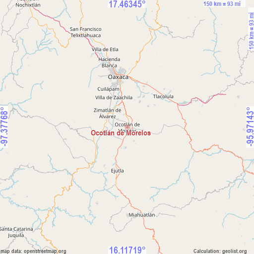
Ocotlán de Morelos GPS coordinates[2]
16° 47' 29.436" North, 96° 40' 28.38" West
| Map corner | latitude | longitude |
|---|---|---|
| Upper-left | 17.46345°, | -97.37768° |
| Center: | 16.79151°, | -96.67455° |
| Lower-right: | 16.11719°, | -95.97143° |
| Map W x H: | 149.7×149.7 km | = 93×93mi |
| max Lat: | 32.7° ⇑91.9% North |
| Ocotlán de Morelos: | 16.79151° |
| min Lat: | ⇓8.1% South 14.53588° |
| min Long | Ocotlán de Mor | max Long |
| -117.105° | -96.67455° | -86.73105° |
| W 78.6%⇐ | ⇒21.4% E |
Elevation
Elevation of Ocotlán de Morelos is 1523 m = 4997 ft, and this is 269.3 m = 884 ft above average elevation for this country.
| Max E: |
3497 m = 11473 ft | 48% |
| Ocotlán de Morelos | 1523 m 4997 ft | |
| Avg. | 1253.7 m = 4113 ft | |
Min E: |
-1 m = -3 ft | 52% |
See also: Mexico elevation on elevation.city.
Geographical zone
Ocotlán de Morelos is located in North Torrid zone (between Equator and Tropic of Cancer). Distance of this Northern Tropic circle is 738.9 km =459.1 mi to North.| Distance of | km | miles | from Ocotlán de Morelos |
|---|---|---|---|
| North Pole | 8140 | 5058 | to North |
| Arctic Circle | 5534.1 | 3438.7 | to North |
| Tropic Cancer | 738.9 | 459.1 | to North |
| Equator | 1867 | 1160.1 | to South |


Nearby cities:
15 places around Ocotlán de Morelos: (largest is in red/bold)
• Asunción Ocotlán
6 km =3.7 mi,  236°
236°
• Praxedis de Guerrero
8.8 km =5.5 mi,  155°
155°
• San Antonino Castillo Velasco
1.4 km =0.9 mi,  321°
321°
• San Dionisio Ocotlán
5 km =3.1 mi,  186°
186°
• San Jacinto Chilateca
5.5 km =3.4 mi,  348°
348°
• San Juan Chilateca
4.4 km =2.7 mi,  7°
7°
• San Martín Tilcajete
7.9 km =4.9 mi,  344°
344°
• San Pedro Apóstol
8.1 km =5 mi,  221°
221°
• San Pedro Guegorexe
9 km =5.6 mi,  1°
1°
• San Pedro Martir
6.6 km =4.1 mi, 215°
• Santa Ana Zegache
7.7 km =4.8 mi,  310°
310°
• Santa Catarina Minas
6.4 km =4 mi,  101°
101°
• Santa Lucía Ocotlán
5.9 km =3.7 mi, 185°
• Santiago Apostol
5.1 km =3.2 mi,  285°
285°
• Santo Tomás Jalieza
5.9 km =3.7 mi, 4°
Sources, notices
• [Note1] Compared only with cities in Mexico existing in our database
• [Src1] Map data: © OpenStreetMap contributors (CC-BY-SA)
• [Src2] Other city data from geonames.org with taken over terms of usage.
• [Src3] Geographical zone / Annual Mean Temperature by Robert A. Rohde @ Wikipedia
