La Reforma geodata
La Reforma (Oaxaca) is a populated place; located in Mexico in America/Mexico_City (GMT-6) time zone. With population of 651 people, there are 13306 cities with bigger population in this country. Compared to other cities in Mexico, 97.3% of cities are located further ↑North; 75.1% of cities are located further ←West and 75.9% of cities have higher elevation than La Reforma. Note1


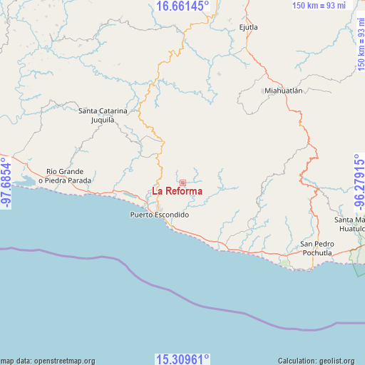
La Reforma GPS coordinates[2]
15° 59' 12.012" North, 96° 58' 56.172" West
| Map corner | latitude | longitude |
|---|---|---|
| Upper-left | 16.66145°, | -97.6854° |
| Center: | 15.98667°, | -96.98227° |
| Lower-right: | 15.30961°, | -96.27915° |
| Map W x H: | 150.3×150.3 km | = 93.4×93.4mi |
| max Lat: | 32.7° ⇑97.3% North |
| La Reforma: | 15.98667° |
| min Lat: | ⇓2.7% South 14.53588° |
| min Long | La Reforma | max Long |
| -117.105° | -96.98227° | -86.73105° |
| W 75.1%⇐ | ⇒24.9% E |
Elevation
Elevation of La Reforma is 191 m = 627 ft, and this is 1062.7 m = 3487 ft below average elevation for this country.
| Max E: |
3497 m = 11473 ft | 75.9% |
| Avg. | 1253.7 m = 4113 ft | |
| La Reforma | 191 m = 627 ft | |
Min E: |
-1 m = -3 ft | 24.1% |
See also: Mexico elevation on elevation.city.
Geographical zone
La Reforma is located in North Torrid zone (between Equator and Tropic of Cancer). Distance of this Northern Tropic circle is 828.4 km =514.7 mi to North.| Distance of | km | miles | from La Reforma |
|---|---|---|---|
| North Pole | 8229.5 | 5113.6 | to North |
| Arctic Circle | 5623.6 | 3494.3 | to North |
| Tropic Cancer | 828.4 | 514.7 | to North |
| Equator | 1777.6 | 1104.5 | to South |


Nearby cities:
15 places around La Reforma: (largest is in red/bold)
• Bajos de Chila
16.4 km =10.2 mi,  244°
244°
• Barra de Navidad
18.8 km =11.7 mi,  192°
192°
• Brisas de Zicatela
17.8 km =11.1 mi,  200°
200°
• Colonia Libertad
15.3 km =9.5 mi,  211°
211°
• El Huarumbo
11.1 km =6.9 mi,  272°
272°
• La Barra de Colotepec
18.6 km =11.6 mi, 195°
• La Ventanilla
19.5 km =12.1 mi,  176°
176°
• Las Palmas
18.4 km =11.4 mi,  337°
337°
• Puerto Escondido
16.4 km =10.2 mi,  218°
218°
• San Andrés Copala
17.4 km =10.8 mi, 274°
• San Gabriel Mixtepec
16.2 km =10.1 mi,  318°
318°
• San José Llano Cieneguilla
9.3 km =5.8 mi,  59°
59°
• San Pedro Mixtepec
10.4 km =6.5 mi, 267°
• Santa María Colotepec
10.9 km =6.8 mi,  155°
155°
• Soledad Piedra Larga
17.1 km =10.6 mi, 343°
Sources, notices
• [Note1] Compared only with cities in Mexico existing in our database
• [Src1] Map data: © OpenStreetMap contributors (CC-BY-SA)
• [Src2] Other city data from geonames.org with taken over terms of usage.
• [Src3] Geographical zone / Annual Mean Temperature by Robert A. Rohde @ Wikipedia
