San Dionisio Ocotepec geodata
San Dionisio Ocotepec (Oaxaca) is a seat of a second-order administrative division; located in Mexico in America/Mexico_City (GMT-6) time zone. With population of 5,459 people, there are 1703 cities with bigger population in this country. Compared to other cities in Mexico, 91.6% of cities are located further ↑North; 80.3% of cities are located further ←West and 58.2% of cities have lower elevation than San Dionisio Ocotepec. Note1
Current local time in San Dionisio Ocotepec:
06:48 AM, WednesdayDifference from your time zone: hours


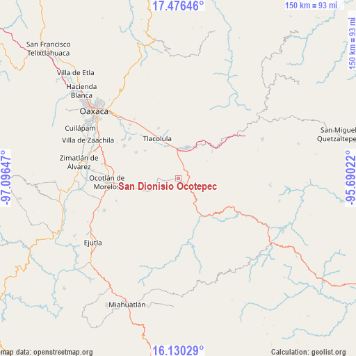
San Dionisio Ocotepec GPS coordinates[2]
16° 48' 16.452" North, 96° 23' 36.024" West
| Map corner | latitude | longitude |
|---|---|---|
| Upper-left | 17.47646°, | -97.09647° |
| Center: | 16.80457°, | -96.39334° |
| Lower-right: | 16.13029°, | -95.69022° |
| Map W x H: | 149.7×149.7 km | = 93×93mi |
| max Lat: | 32.7° ⇑91.6% North |
| San Dionisio Ocotepec: | 16.80457° |
| min Lat: | ⇓8.4% South 14.53588° |
| min Long | San Dionisio Oc | max Long |
| -117.105° | -96.39334° | -86.73105° |
| W 80.3%⇐ | ⇒19.7% E |
Elevation
Elevation of San Dionisio Ocotepec is 1694 m = 5558 ft, and this is 440.3 m = 1445 ft above average elevation for this country.
| Max E: |
3497 m = 11473 ft | 41.8% |
| San Dionisio Ocotepec | 1694 m 5558 ft | |
| Avg. | 1253.7 m = 4113 ft | |
Min E: |
-1 m = -3 ft | 58.2% |
See also: Mexico elevation on elevation.city.
Geographical zone
San Dionisio Ocotepec is located in North Torrid zone (between Equator and Tropic of Cancer). Distance of this Northern Tropic circle is 737.4 km =458.2 mi to North.| Distance of | km | miles | from San Dionisio Ocotepec |
|---|---|---|---|
| North Pole | 8138.6 | 5057.1 | to North |
| Arctic Circle | 5532.7 | 3437.9 | to North |
| Tropic Cancer | 737.4 | 458.2 | to North |
| Equator | 1868.5 | 1161 | to South |


Nearby cities:
15 places around San Dionisio Ocotepec: (largest is in red/bold)
• San Baltazar Chichicapam
11.3 km =7 mi,  244°
244°
• San Baltazar Guelavila
9.4 km =5.8 mi,  95°
95°
• San Bartolomé Quialana
15.9 km =9.9 mi,  313°
313°
• San Lorenzo Albarradas
18.6 km =11.6 mi,  50°
50°
• San Lucas Quiavini
12.9 km =8 mi,  321°
321°
• San Marcos Tlapazola
18.3 km =11.4 mi, 310°
• San Pablo Güilá
5 km =3.1 mi,  268°
268°
• San Pablo Villa de Mitla
13.6 km =8.5 mi,  15°
15°
• San Pedro Totolápam
17.6 km =10.9 mi,  148°
148°
• Santiago Matatlán
6.8 km =4.2 mi,  9°
9°
• Santo Tomás de Arriba
17 km =10.6 mi, 100°
• Tlacolula de Matamoros
18.9 km =11.7 mi,  332°
332°
• Unión Zapata
12.8 km =8 mi,  350°
350°
• Xaaga
13.1 km =8.1 mi,  32°
32°
• Yaxe
12.1 km =7.5 mi,  223°
223°
Sources, notices
• [Note1] Compared only with cities in Mexico existing in our database
• [Src1] Map data: © OpenStreetMap contributors (CC-BY-SA)
• [Src2] Other city data from geonames.org with taken over terms of usage.
• [Src3] Geographical zone / Annual Mean Temperature by Robert A. Rohde @ Wikipedia
