Yaxe geodata
Yaxe (Oaxaca) is a seat of a second-order administrative division; located in Mexico in America/Mexico_City (GMT-6) time zone. With population of 2,683 people, there are 3296 cities with bigger population in this country. Compared to other cities in Mexico, 92.6% of cities are located further ↑North; 79.8% of cities are located further ←West and 51.5% of cities have lower elevation than Yaxe. Note1


Yaxe GPS coordinates[2]
16° 43' 33.42" North, 96° 28' 18.876" West
| Map corner | latitude | longitude |
|---|---|---|
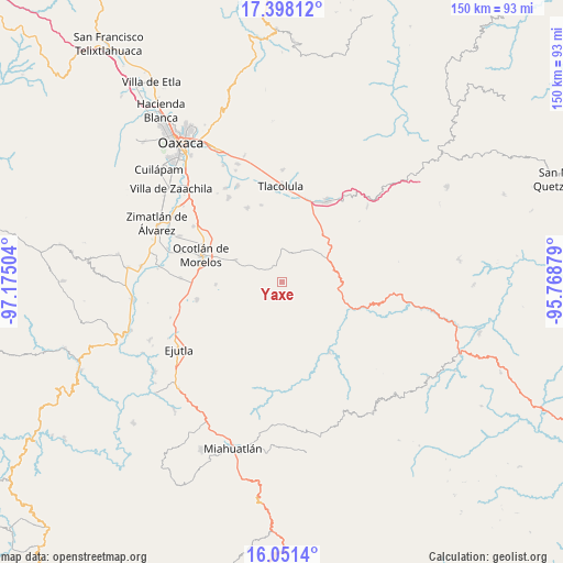
| Upper-left | 17.39812°, | -97.17504° |
| Center: | 16.72595°, | -96.47191° |
| Lower-right: | 16.0514°, | -95.76879° |
| Map W x H: | 149.7×149.7 km | = 93×93mi |
| max Lat: | 32.7° ⇑92.6% North |
| Yaxe: | 16.72595° |
| min Lat: | ⇓7.4% South 14.53588° |
| min Long | Yaxe | max Long |
| -117.105° | -96.47191° | -86.73105° |
| W 79.8%⇐ | ⇒20.2% E |
Elevation
Elevation of Yaxe is 1505 m = 4938 ft, and this is 251.3 m = 824 ft above average elevation for this country.
| Max E: |
3497 m = 11473 ft | 48.5% |
| Yaxe | 1505 m 4938 ft | |
| Avg. | 1253.7 m = 4113 ft | |
Min E: |
-1 m = -3 ft | 51.5% |
See also: Mexico elevation on elevation.city.
Geographical zone
Yaxe is located in North Torrid zone (between Equator and Tropic of Cancer). Distance of this Northern Tropic circle is 746.2 km =463.7 mi to North.| Distance of | km | miles | from Yaxe |
|---|---|---|---|
| North Pole | 8147.3 | 5062.5 | to North |
| Arctic Circle | 5541.4 | 3443.3 | to North |
| Tropic Cancer | 746.2 | 463.7 | to North |
| Equator | 1859.8 | 1155.6 | to South |


Nearby cities:
15 places around Yaxe: (largest is in red/bold)
• Praxedis de Guerrero
17.9 km =11.1 mi,  267°
267°
• San Baltazar Chichicapam
4.4 km =2.7 mi,  334°
334°
• San Baltazar Guelavila
19.4 km =12.1 mi,  66°
66°
• San Dionisio Ocotepec
12.1 km =7.5 mi,  43°
43°
• San Jerónimo Taviche
13 km =8.1 mi,  264°
264°
• San José la Garzona
18.5 km =11.5 mi,  254°
254°
• San Juán Lachigalla
17.3 km =10.7 mi,  208°
208°
• San Lucas Quiavini
18.9 km =11.7 mi,  1°
1°
• San Miguel Tilquiapam
13.3 km =8.3 mi,  298°
298°
• San Pablo Güilá
9.2 km =5.7 mi,  21°
21°
• San Pedro Taviche
11.9 km =7.4 mi,  215°
215°
• San Pedro Totolápam
18.6 km =11.6 mi,  109°
109°
• Santa Catarina Minas
16.4 km =10.2 mi,  291°
291°
• Santiago Matatlán
18.1 km =11.2 mi,  31°
31°
• Santiago la Libertad
19.3 km =12 mi,  199°
199°
Sources, notices
• [Note1] Compared only with cities in Mexico existing in our database
• [Src1] Map data: © OpenStreetMap contributors (CC-BY-SA)
• [Src2] Other city data from geonames.org with taken over terms of usage.
• [Src3] Geographical zone / Annual Mean Temperature by Robert A. Rohde @ Wikipedia
