San Diego Linares geodata
San Diego Linares (Morelos) is a populated place; located in Mexico in America/Mexico_City (GMT-6) time zone. With population of 2,914 people, there are 3057 cities with bigger population in this country. Compared to other cities in Mexico, 56.6% of cities are located further ↑North; 59.2% of cities are located further →East and 96.5% of cities have lower elevation than San Diego Linares. Note1


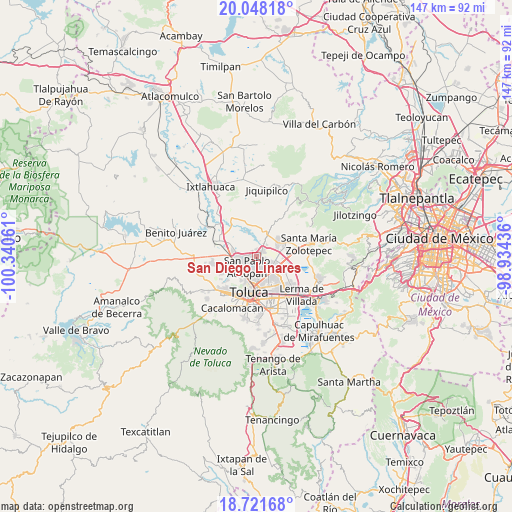
San Diego Linares GPS coordinates[2]
19° 23' 10.608" North, 99° 38' 14.928" West
| Map corner | latitude | longitude |
|---|---|---|
| Upper-left | 20.04818°, | -100.34061° |
| Center: | 19.38628°, | -99.63748° |
| Lower-right: | 18.72168°, | -98.93436° |
| Map W x H: | 147.5×147.5 km | = 91.7×91.7mi |
| max Lat: | 32.7° ⇑56.6% North |
| San Diego Linares: | 19.38628° |
| min Lat: | ⇓43.4% South 14.53588° |
| min Long | San Diego Linar | max Long |
| -117.105° | -99.63748° | -86.73105° |
| W 40.8%⇐ | ⇒59.2% E |
Elevation
Elevation of San Diego Linares is 2651 m = 8698 ft, and this is 1397.3 m = 4584 ft above average elevation for this country.
| Max E: |
3497 m = 11473 ft | 3.5% |
| San Diego Linares | 2651 m 8698 ft | |
| Avg. | 1253.7 m = 4113 ft | |
Min E: |
-1 m = -3 ft | 96.5% |
See also: Mexico elevation on elevation.city.
Geographical zone
San Diego Linares is located in North Torrid zone (between Equator and Tropic of Cancer). Distance of this Northern Tropic circle is 450.4 km =279.9 mi to North.| Distance of | km | miles | from San Diego Linares |
|---|---|---|---|
| North Pole | 7851.5 | 4878.7 | to North |
| Arctic Circle | 5245.6 | 3259.5 | to North |
| Tropic Cancer | 450.4 | 279.9 | to North |
| Equator | 2155.6 | 1339.4 | to South |


Nearby cities:
15 places around San Diego Linares: (largest is in red/bold)
• Barrio Bordo Nuevo
3.8 km =2.4 mi,  258°
258°
• Barrio Santa Cruz
4.7 km =2.9 mi,  214°
214°
• Barrio del Cajón
2.2 km =1.4 mi,  284°
284°
• Fraccionamiento Real de San Pablo
1.2 km =0.7 mi,  286°
286°
• Galaxias Toluca
1.9 km =1.2 mi,  314°
314°
• Jicaltepec Autopan
1.7 km =1.1 mi,  192°
192°
• Jicaltepec Cuexcontitlán
1.8 km =1.1 mi,  144°
144°
• La Loma Cuexcontitlán
1.4 km =0.9 mi,  239°
239°
• Llano de la Y
2.9 km =1.8 mi,  50°
50°
• Loma de Progreso
4.7 km =2.9 mi,  14°
14°
• San Andrés Cuexcontitlán
3.5 km =2.2 mi,  151°
151°
• San Antonio del Puente
4.1 km =2.5 mi,  30°
30°
• San Diego los Padres Cuexcontitlán Sección 5 B
2.9 km =1.8 mi,  113°
113°
• San José la Costa
5.1 km =3.2 mi,  353°
353°
• San Pablo Autopan
3.9 km =2.4 mi, 211°
Sources, notices
• [Note1] Compared only with cities in Mexico existing in our database
• [Src1] Map data: © OpenStreetMap contributors (CC-BY-SA)
• [Src2] Other city data from geonames.org with taken over terms of usage.
• [Src3] Geographical zone / Annual Mean Temperature by Robert A. Rohde @ Wikipedia
