San Baltazar Loxicha geodata
San Baltazar Loxicha (Oaxaca) is a seat of a second-order administrative division; located in Mexico in America/Mexico_City (GMT-6) time zone. With population of 2,175 people, there are 4044 cities with bigger population in this country. Compared to other cities in Mexico, 97% of cities are located further ↑North; 77.4% of cities are located further ←West and 60.1% of cities have higher elevation than San Baltazar Loxicha. Note1


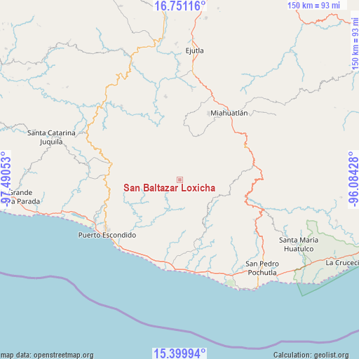
San Baltazar Loxicha GPS coordinates[2]
16° 4' 36.12" North, 96° 47' 14.64" West
| Map corner | latitude | longitude |
|---|---|---|
| Upper-left | 16.75116°, | -97.49053° |
| Center: | 16.0767°, | -96.7874° |
| Lower-right: | 15.39994°, | -96.08428° |
| Map W x H: | 150.2×150.2 km | = 93.3×93.3mi |
| max Lat: | 32.7° ⇑97% North |
| San Baltazar Loxicha: | 16.0767° |
| min Lat: | ⇓3% South 14.53588° |
| min Long | San Baltazar Lo | max Long |
| -117.105° | -96.7874° | -86.73105° |
| W 77.4%⇐ | ⇒22.6% E |
Elevation
Elevation of San Baltazar Loxicha is 999 m = 3278 ft, and this is 254.7 m = 836 ft below average elevation for this country.
| Max E: |
3497 m = 11473 ft | 60.1% |
| Avg. | 1253.7 m = 4113 ft | |
| San Baltazar Loxicha | 999 m = 3278 ft | |
Min E: |
-1 m = -3 ft | 39.9% |
See also: Mexico elevation on elevation.city.
Geographical zone
San Baltazar Loxicha is located in North Torrid zone (between Equator and Tropic of Cancer). Distance of this Northern Tropic circle is 818.4 km =508.5 mi to North.| Distance of | km | miles | from San Baltazar Loxicha |
|---|---|---|---|
| North Pole | 8219.5 | 5107.4 | to North |
| Arctic Circle | 5613.6 | 3488.1 | to North |
| Tropic Cancer | 818.4 | 508.5 | to North |
| Equator | 1787.6 | 1110.8 | to South |


Nearby cities:
15 places around San Baltazar Loxicha: (largest is in red/bold)
• La Sirena
18.6 km =11.6 mi,  129°
129°
• Piedra Virgen
19.5 km =12.1 mi,  137°
137°
• Quelové
15.6 km =9.7 mi, 132°
• San Agustín Loxicha
19.5 km =12.1 mi,  109°
109°
• San Bartolomé Loxícha
14.5 km =9 mi,  145°
145°
• San Francisco Coatlán
12 km =7.5 mi,  13°
13°
• San Jerónimo Coatlán
19.4 km =12.1 mi,  332°
332°
• San José Llano Cieneguilla
13.9 km =8.6 mi,  247°
247°
• San Miguel Coatlán
16.7 km =10.4 mi,  36°
36°
• San Pablo Coatlán
16.4 km =10.2 mi,  1°
1°
• San Pedro Coatlán
20.2 km =12.6 mi, 13°
• San Sebastián Coatlán
14.6 km =9.1 mi,  343°
343°
• San Vicente Yogodoy
18.2 km =11.3 mi,  92°
92°
• Santa Catarina Loxicha
3.7 km =2.3 mi,  104°
104°
• Santa Cruz Loxícha
14.1 km =8.8 mi, 125°
Sources, notices
• [Note1] Compared only with cities in Mexico existing in our database
• [Src1] Map data: © OpenStreetMap contributors (CC-BY-SA)
• [Src2] Other city data from geonames.org with taken over terms of usage.
• [Src3] Geographical zone / Annual Mean Temperature by Robert A. Rohde @ Wikipedia
