San Antonio Rayón geodata
San Antonio Rayón (Puebla) is a populated place; located in Mexico in America/Mexico_City (GMT-6) time zone. With population of 748 people, there are 11708 cities with bigger population in this country. Compared to other cities in Mexico, 59.4% of cities are located further ↓South; 69.7% of cities are located further ←West and 76.3% of cities have higher elevation than San Antonio Rayón. Note1


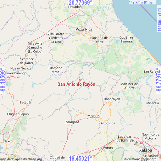
San Antonio Rayón GPS coordinates[2]
20° 6' 42.624" North, 97° 28' 58.296" West
| Map corner | latitude | longitude |
|---|---|---|
| Upper-left | 20.77069°, | -98.18599° |
| Center: | 20.11184°, | -97.48286° |
| Lower-right: | 19.45021°, | -96.77974° |
| Map W x H: | 146.8×146.8 km | = 91.2×91.2mi |
| max Lat: | 32.7° ⇑40.6% North |
| San Antonio Rayón: | 20.11184° |
| min Lat: | ⇓59.4% South 14.53588° |
| min Long | San Antonio Ray | max Long |
| -117.105° | -97.48286° | -86.73105° |
| W 69.7%⇐ | ⇒30.3% E |
Elevation
Elevation of San Antonio Rayón is 176 m = 577 ft, and this is 1077.7 m = 3536 ft below average elevation for this country.
| Max E: |
3497 m = 11473 ft | 76.3% |
| Avg. | 1253.7 m = 4113 ft | |
| San Antonio Rayón | 176 m = 577 ft | |
Min E: |
-1 m = -3 ft | 23.7% |
See also: Mexico elevation on elevation.city.
Geographical zone
San Antonio Rayón is located in North Torrid zone (between Equator and Tropic of Cancer). Distance of this Northern Tropic circle is 369.7 km =229.7 mi to North.| Distance of | km | miles | from San Antonio Rayón |
|---|---|---|---|
| North Pole | 7770.8 | 4828.5 | to North |
| Arctic Circle | 5164.9 | 3209.3 | to North |
| Tropic Cancer | 369.7 | 229.7 | to North |
| Equator | 2236.2 | 1389.5 | to South |


Nearby cities:
15 places around San Antonio Rayón: (largest is in red/bold)
• Buena Vista
3.5 km =2.2 mi,  59°
59°
• Caxuxuman
7.4 km =4.6 mi,  303°
303°
• Cuauhtapanaloyan
5.1 km =3.2 mi,  148°
148°
• Reyes de Vallarta
5.1 km =3.2 mi,  264°
264°
• Santiago Yancuictlalpan
5.8 km =3.6 mi,  168°
168°
• Tacuapan
3.3 km =2.1 mi, 169°
• Tecpantzingo
2 km =1.2 mi,  125°
125°
• Tecuantepec
4.1 km =2.5 mi,  334°
334°
• Tepetitán Reyeshogpan de Hidalgo
3.3 km =2.1 mi,  199°
199°
• Tepetzintán
7.6 km =4.7 mi,  208°
208°
• Tuzamapan Xiloxochico
6.1 km =3.8 mi,  185°
185°
• Xalcuahuta
4 km =2.5 mi,  228°
228°
• Xaltipan
5.7 km =3.5 mi,  242°
242°
• Xiloxochico de Rafael Ávila Camacho
7.4 km =4.6 mi, 186°
• Yohualichan
6 km =3.7 mi, 200°
Sources, notices
• [Note1] Compared only with cities in Mexico existing in our database
• [Src1] Map data: © OpenStreetMap contributors (CC-BY-SA)
• [Src2] Other city data from geonames.org with taken over terms of usage.
• [Src3] Geographical zone / Annual Mean Temperature by Robert A. Rohde @ Wikipedia
