Cuauhtapanaloyan geodata
Cuauhtapanaloyan (Puebla) is a populated place; located in Mexico in America/Mexico_City (GMT-6) time zone. With population of 556 people, there are 15345 cities with bigger population in this country. Compared to other cities in Mexico, 58.6% of cities are located further ↓South; 70% of cities are located further ←West and 71% of cities have higher elevation than Cuauhtapanaloyan. Note1


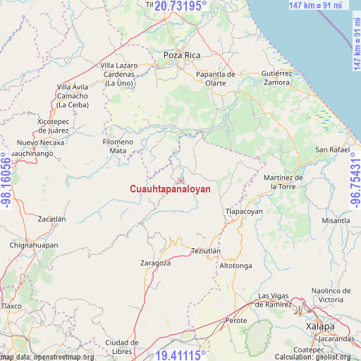
Cuauhtapanaloyan GPS coordinates[2]
20° 4' 22.584" North, 97° 27' 26.748" West
| Map corner | latitude | longitude |
|---|---|---|
| Upper-left | 20.73195°, | -98.16056° |
| Center: | 20.07294°, | -97.45743° |
| Lower-right: | 19.41115°, | -96.75431° |
| Map W x H: | 146.9×146.9 km | = 91.3×91.3mi |
| max Lat: | 32.7° ⇑41.4% North |
| Cuauhtapanaloyan: | 20.07294° |
| min Lat: | ⇓58.6% South 14.53588° |
| min Long | Cuauhtapanaloya | max Long |
| -117.105° | -97.45743° | -86.73105° |
| W 70%⇐ | ⇒30% E |
Elevation
Elevation of Cuauhtapanaloyan is 371 m = 1217 ft, and this is 882.7 m = 2896 ft below average elevation for this country.
| Max E: |
3497 m = 11473 ft | 71% |
| Avg. | 1253.7 m = 4113 ft | |
| Cuauhtapanaloyan | 371 m = 1217 ft | |
Min E: |
-1 m = -3 ft | 29% |
See also: Mexico elevation on elevation.city.
Geographical zone
Cuauhtapanaloyan is located in North Torrid zone (between Equator and Tropic of Cancer). Distance of this Northern Tropic circle is 374 km =232.4 mi to North.| Distance of | km | miles | from Cuauhtapanaloyan |
|---|---|---|---|
| North Pole | 7775.2 | 4831.3 | to North |
| Arctic Circle | 5169.3 | 3212.1 | to North |
| Tropic Cancer | 374 | 232.4 | to North |
| Equator | 2231.9 | 1386.8 | to South |


Nearby cities:
15 places around Cuauhtapanaloyan: (largest is in red/bold)
• Ayotoxco de Guerrero
5.6 km =3.5 mi,  62°
62°
• Buena Vista
6.1 km =3.8 mi,  3°
3°
• Nectepec
5 km =3.1 mi,  160°
160°
• Pepexta
3.6 km =2.2 mi,  186°
186°
• San Antonio Rayón
5.1 km =3.2 mi,  328°
328°
• Santiago Yancuictlalpan
2 km =1.2 mi,  229°
229°
• Tacuapan
2.3 km =1.4 mi,  298°
298°
• Tecpantzingo
3.3 km =2.1 mi,  342°
342°
• Tepetitán Reyeshogpan de Hidalgo
4 km =2.5 mi,  287°
287°
• Tuzamapan Xiloxochico
3.7 km =2.3 mi,  241°
241°
• Xalcuahuta
5.9 km =3.7 mi, 286°
• Xalpantzingo
5.6 km =3.5 mi,  195°
195°
• Xiloxochico de Rafael Ávila Camacho
4.6 km =2.9 mi, 229°
• Yohualichan
5 km =3.1 mi,  255°
255°
• Zacatipan
4.4 km =2.7 mi,  149°
149°
Sources, notices
• [Note1] Compared only with cities in Mexico existing in our database
• [Src1] Map data: © OpenStreetMap contributors (CC-BY-SA)
• [Src2] Other city data from geonames.org with taken over terms of usage.
• [Src3] Geographical zone / Annual Mean Temperature by Robert A. Rohde @ Wikipedia
