Xaltipan geodata
Xaltipan (Puebla) is a populated place; located in Mexico in America/Mexico_City (GMT-6) time zone. With population of 739 people, there are 11825 cities with bigger population in this country. Compared to other cities in Mexico, 58.9% of cities are located further ↓South; 69.2% of cities are located further ←West and 72.4% of cities have higher elevation than Xaltipan. Note1


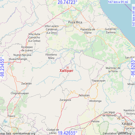
Xaltipan GPS coordinates[2]
20° 5' 17.808" North, 97° 31' 53.112" West
| Map corner | latitude | longitude |
|---|---|---|
| Upper-left | 20.74723°, | -98.23455° |
| Center: | 20.08828°, | -97.53142° |
| Lower-right: | 19.42655°, | -96.8283° |
| Map W x H: | 146.8×146.8 km | = 91.2×91.2mi |
| max Lat: | 32.7° ⇑41.1% North |
| Xaltipan: | 20.08828° |
| min Lat: | ⇓58.9% South 14.53588° |
| min Long | Xaltipan | max Long |
| -117.105° | -97.53142° | -86.73105° |
| W 69.2%⇐ | ⇒30.8% E |
Elevation
Elevation of Xaltipan is 314 m = 1030 ft, and this is 939.7 m = 3083 ft below average elevation for this country.
| Max E: |
3497 m = 11473 ft | 72.4% |
| Avg. | 1253.7 m = 4113 ft | |
| Xaltipan | 314 m = 1030 ft | |
Min E: |
-1 m = -3 ft | 27.6% |
See also: Mexico elevation on elevation.city.
Geographical zone
Xaltipan is located in North Torrid zone (between Equator and Tropic of Cancer). Distance of this Northern Tropic circle is 372.3 km =231.3 mi to North.| Distance of | km | miles | from Xaltipan |
|---|---|---|---|
| North Pole | 7773.5 | 4830.2 | to North |
| Arctic Circle | 5167.6 | 3211 | to North |
| Tropic Cancer | 372.3 | 231.3 | to North |
| Equator | 2233.6 | 1387.9 | to South |


Nearby cities:
15 places around Xaltipan: (largest is in red/bold)
• Acatzácatl
6.1 km =3.8 mi,  294°
294°
• Anayal Número Uno
5.7 km =3.5 mi,  338°
338°
• Ayotzinapan
3.6 km =2.2 mi,  190°
190°
• Ecatlán (Santiago Ecatlán)
4.7 km =2.9 mi,  214°
214°
• Reyes de Vallarta
2.1 km =1.3 mi,  359°
359°
• San Antonio Rayón
5.7 km =3.5 mi,  62°
62°
• Tacuapan
5.7 km =3.5 mi,  95°
95°
• Tepetitán Reyeshogpan de Hidalgo
4 km =2.5 mi, 97°
• Tepetzintán
4.4 km =2.7 mi,  160°
160°
• Tuzamapan
5.2 km =3.2 mi,  241°
241°
• Tuzamapan Xiloxochico
5.6 km =3.5 mi,  127°
127°
• Xalcuahuta
2 km =1.2 mi,  90°
90°
• Xiloxochico de Rafael Ávila Camacho
6.3 km =3.9 mi,  138°
138°
• Yohualichan
4.2 km =2.6 mi, 135°
• Zozocolco de Guerrero
4.3 km =2.7 mi, 293°
Sources, notices
• [Note1] Compared only with cities in Mexico existing in our database
• [Src1] Map data: © OpenStreetMap contributors (CC-BY-SA)
• [Src2] Other city data from geonames.org with taken over terms of usage.
• [Src3] Geographical zone / Annual Mean Temperature by Robert A. Rohde @ Wikipedia
