San Agustín Zapotlán geodata
San Agustín Zapotlán (Hidalgo) is a populated place; located in Mexico in America/Mexico_City (GMT-6) time zone. With population of 1,204 people, there are 7219 cities with bigger population in this country. Compared to other cities in Mexico, 54.6% of cities are located further ↓South; 54.9% of cities are located further ←West and 89.3% of cities have lower elevation than San Agustín Zapotlán. Note1
Current local time in San Agustín Zapotlán:
05:34 AM, WednesdayDifference from your time zone: hours


San Agustín Zapotlán GPS coordinates[2]
19° 52' 31.8" North, 98° 42' 51.336" West
| Map corner | latitude | longitude |
|---|---|---|
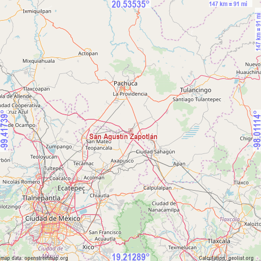
| Upper-left | 20.53535°, | -99.41739° |
| Center: | 19.8755°, | -98.71426° |
| Lower-right: | 19.21289°, | -98.01114° |
| Map W x H: | 147×147 km | = 91.3×91.3mi |
| max Lat: | 32.7° ⇑45.4% North |
| San Agustín Zapotlán: | 19.8755° |
| min Lat: | ⇓54.6% South 14.53588° |
| min Long | San Agustín Za | max Long |
| -117.105° | -98.71426° | -86.73105° |
| W 54.9%⇐ | ⇒45.1% E |
Elevation
Elevation of San Agustín Zapotlán is 2382 m = 7815 ft, and this is 1128.3 m = 3702 ft above average elevation for this country.
| Max E: |
3497 m = 11473 ft | 10.7% |
| San Agustín Zapotlán | 2382 m 7815 ft | |
| Avg. | 1253.7 m = 4113 ft | |
Min E: |
-1 m = -3 ft | 89.3% |
See also: Mexico elevation on elevation.city.
Geographical zone
San Agustín Zapotlán is located in North Torrid zone (between Equator and Tropic of Cancer). Distance of this Northern Tropic circle is 396 km =246.1 mi to North.| Distance of | km | miles | from San Agustín Zapotlán |
|---|---|---|---|
| North Pole | 7797.1 | 4844.9 | to North |
| Arctic Circle | 5191.2 | 3225.7 | to North |
| Tropic Cancer | 396 | 246.1 | to North |
| Equator | 2209.9 | 1373.2 | to South |


Nearby cities:
15 places around San Agustín Zapotlán: (largest is in red/bold)
• Colonia Benito Juárez
9.8 km =6.1 mi,  279°
279°
• Colonia Guadalupe
8.9 km =5.5 mi,  322°
322°
• Guadalupe Relinas
6.5 km =4 mi,  269°
269°
• La Trinidad
9.4 km =5.8 mi,  3°
3°
• San Antonio Coayuca
9.7 km =6 mi,  254°
254°
• San Antonio Ostoyucan
7.9 km =4.9 mi,  40°
40°
• San Felipe Teotitlán
8 km =5 mi,  170°
170°
• San Felipe Zacatepec
8.3 km =5.2 mi,  243°
243°
• San Gabriel Azteca
10.3 km =6.4 mi,  86°
86°
• San Pablo Xúchil
9.2 km =5.7 mi,  214°
214°
• San Pedro Tlaquilpan
8.7 km =5.4 mi,  332°
332°
• Santa Cruz
9.7 km =6 mi,  19°
19°
• Santa María Actipac
4 km =2.5 mi, 235°
• Santiago Tepeyahualco
5.5 km =3.4 mi,  122°
122°
• Zempoala
6.8 km =4.2 mi,  48°
48°
Sources, notices
• [Note1] Compared only with cities in Mexico existing in our database
• [Src1] Map data: © OpenStreetMap contributors (CC-BY-SA)
• [Src2] Other city data from geonames.org with taken over terms of usage.
• [Src3] Geographical zone / Annual Mean Temperature by Robert A. Rohde @ Wikipedia
