San Gabriel Azteca geodata
San Gabriel Azteca (Hidalgo) is a populated place; located in Mexico in America/Mexico_City (GMT-6) time zone. With population of 1,009 people, there are 8636 cities with bigger population in this country. Compared to other cities in Mexico, 54.7% of cities are located further ↓South; 55.9% of cities are located further ←West and 93.8% of cities have lower elevation than San Gabriel Azteca. Note1


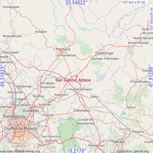
San Gabriel Azteca GPS coordinates[2]
19° 52' 49.404" North, 98° 36' 57.96" West
| Map corner | latitude | longitude |
|---|---|---|
| Upper-left | 20.54022°, | -99.31923° |
| Center: | 19.88039°, | -98.6161° |
| Lower-right: | 19.2178°, | -97.91298° |
| Map W x H: | 147×147 km | = 91.3×91.3mi |
| max Lat: | 32.7° ⇑45.3% North |
| San Gabriel Azteca: | 19.88039° |
| min Lat: | ⇓54.7% South 14.53588° |
| min Long | San Gabriel Azt | max Long |
| -117.105° | -98.6161° | -86.73105° |
| W 55.9%⇐ | ⇒44.1% E |
Elevation
Elevation of San Gabriel Azteca is 2562 m = 8406 ft, and this is 1308.3 m = 4292 ft above average elevation for this country.
| Max E: |
3497 m = 11473 ft | 6.2% |
| San Gabriel Azteca | 2562 m 8406 ft | |
| Avg. | 1253.7 m = 4113 ft | |
Min E: |
-1 m = -3 ft | 93.8% |
See also: Mexico elevation on elevation.city.
Geographical zone
San Gabriel Azteca is located in North Torrid zone (between Equator and Tropic of Cancer). Distance of this Northern Tropic circle is 395.4 km =245.7 mi to North.| Distance of | km | miles | from San Gabriel Azteca |
|---|---|---|---|
| North Pole | 7796.6 | 4844.6 | to North |
| Arctic Circle | 5190.7 | 3225.4 | to North |
| Tropic Cancer | 395.4 | 245.7 | to North |
| Equator | 2210.5 | 1373.5 | to South |


Nearby cities:
15 places around San Gabriel Azteca: (largest is in red/bold)
• Chiconcuac
6.1 km =3.8 mi,  182°
182°
• Ciudad Sahagun
12.4 km =7.7 mi,  159°
159°
• Francisco Villa
7.8 km =4.8 mi,  31°
31°
• San Agustín Zapotlán
10.3 km =6.4 mi,  266°
266°
• San Antonio Ostoyucan
7.5 km =4.7 mi,  317°
317°
• San Felipe Teotitlán
12.3 km =7.6 mi,  226°
226°
• San Isidro
10.5 km =6.5 mi,  165°
165°
• Santa Cruz
11.1 km =6.9 mi, 320°
• Santa María Tecajete
6.9 km =4.3 mi,  19°
19°
• Santa Mónica
11.5 km =7.1 mi,  357°
357°
• Santiago Tepeyahualco
6.6 km =4.1 mi,  237°
237°
• Santo Tomas
5.6 km =3.5 mi,  62°
62°
• Tepeapulco
12.2 km =7.6 mi,  147°
147°
• Tlanalapa
7 km =4.3 mi, 169°
• Zempoala
6.5 km =4 mi,  307°
307°
Sources, notices
• [Note1] Compared only with cities in Mexico existing in our database
• [Src1] Map data: © OpenStreetMap contributors (CC-BY-SA)
• [Src2] Other city data from geonames.org with taken over terms of usage.
• [Src3] Geographical zone / Annual Mean Temperature by Robert A. Rohde @ Wikipedia
