San Antonio Ostoyucan geodata
San Antonio Ostoyucan (Hidalgo) is a populated place; located in Mexico in America/Mexico_City (GMT-6) time zone. With population of 725 people, there are 12042 cities with bigger population in this country. Compared to other cities in Mexico, 55.6% of cities are located further ↓South; 55.5% of cities are located further ←West and 91% of cities have lower elevation than San Antonio Ostoyucan. Note1
Current local time in San Antonio Ostoyucan:
12:46 AM, WednesdayDifference from your time zone: hours


San Antonio Ostoyucan GPS coordinates[2]
19° 55' 47.208" North, 98° 39' 53.892" West
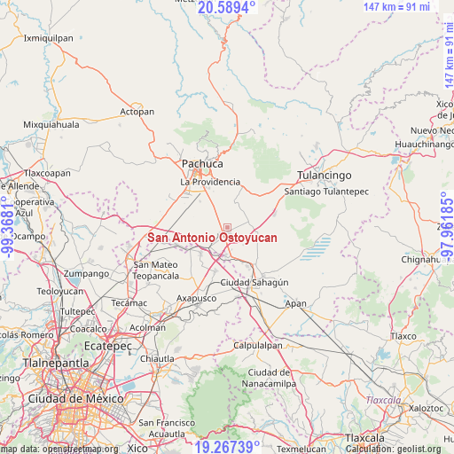
| Map corner | latitude | longitude |
|---|---|---|
| Upper-left | 20.5894°, | -99.3681° |
| Center: | 19.92978°, | -98.66497° |
| Lower-right: | 19.26739°, | -97.96185° |
| Map W x H: | 147×147 km | = 91.3×91.3mi |
| max Lat: | 32.7° ⇑44.4% North |
| San Antonio Ostoyucan: | 19.92978° |
| min Lat: | ⇓55.6% South 14.53588° |
| min Long | San Antonio Ost | max Long |
| -117.105° | -98.66497° | -86.73105° |
| W 55.5%⇐ | ⇒44.5% E |
Elevation
Elevation of San Antonio Ostoyucan is 2439 m = 8002 ft, and this is 1185.3 m = 3889 ft above average elevation for this country.
| Max E: |
3497 m = 11473 ft | 9% |
| San Antonio Ostoyucan | 2439 m 8002 ft | |
| Avg. | 1253.7 m = 4113 ft | |
Min E: |
-1 m = -3 ft | 91% |
See also: Mexico elevation on elevation.city.
Geographical zone
San Antonio Ostoyucan is located in North Torrid zone (between Equator and Tropic of Cancer). Distance of this Northern Tropic circle is 389.9 km =242.3 mi to North.| Distance of | km | miles | from San Antonio Ostoyucan |
|---|---|---|---|
| North Pole | 7791.1 | 4841.2 | to North |
| Arctic Circle | 5185.2 | 3221.9 | to North |
| Tropic Cancer | 389.9 | 242.3 | to North |
| Equator | 2216 | 1377 | to South |


Nearby cities:
15 places around San Antonio Ostoyucan: (largest is in red/bold)
• Colonia Guadalupe
10.6 km =6.6 mi,  275°
275°
• Epazoyucan
10.3 km =6.4 mi,  17°
17°
• Francisco Villa
9.2 km =5.7 mi,  82°
82°
• La Trinidad
5.7 km =3.5 mi,  305°
305°
• San Agustín Zapotlán
7.9 km =4.9 mi,  220°
220°
• San Gabriel Azteca
7.5 km =4.7 mi,  137°
137°
• San Pedro Tlaquilpan
9.4 km =5.8 mi, 280°
• Santa Cruz
3.7 km =2.3 mi,  327°
327°
• Santa María Tecajete
7.5 km =4.7 mi, 81°
• Santa Mónica
7.5 km =4.7 mi,  37°
37°
• Santiago Tepeyahualco
9 km =5.6 mi,  183°
183°
• Santo Tomas
10.5 km =6.5 mi,  106°
106°
• Villa Margarita
7.9 km =4.9 mi,  316°
316°
• Xochihuacán
7.9 km =4.9 mi, 323°
• Zempoala
1.6 km =1 mi, 183°
Sources, notices
• [Note1] Compared only with cities in Mexico existing in our database
• [Src1] Map data: © OpenStreetMap contributors (CC-BY-SA)
• [Src2] Other city data from geonames.org with taken over terms of usage.
• [Src3] Geographical zone / Annual Mean Temperature by Robert A. Rohde @ Wikipedia
