Samahil geodata
Samahil (Yucatán) is a populated place; located in Mexico in America/Merida (GMT-6) time zone. With population of 2,826 people, there are 3140 cities with bigger population in this country. Compared to other cities in Mexico, 74.6% of cities are located further ↓South; 97.6% of cities are located further ←West and 98.1% of cities have higher elevation than Samahil. Note1


Samahil GPS coordinates[2]
20° 53' 0.744" North, 89° 53' 18.096" West
| Map corner | latitude | longitude |
|---|---|---|
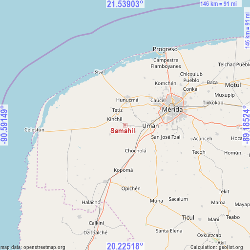
| Upper-left | 21.53903°, | -90.59149° |
| Center: | 20.88354°, | -89.88836° |
| Lower-right: | 20.22518°, | -89.18524° |
| Map W x H: | 146.1×146.1 km | = 90.8×90.8mi |
| max Lat: | 32.7° ⇑25.4% North |
| Samahil: | 20.88354° |
| min Lat: | ⇓74.6% South 14.53588° |
| min Long | Samahil | max Long |
| -117.105° | -89.88836° | -86.73105° |
| W 97.6%⇐ | ⇒2.4% E |
Elevation
Elevation of Samahil is 8 m = 26 ft, and this is 1245.7 m = 4087 ft below average elevation for this country.
| Max E: |
3497 m = 11473 ft | 98.1% |
| Avg. | 1253.7 m = 4113 ft | |
| Samahil | 8 m = 26 ft | |
Min E: |
-1 m = -3 ft | 1.9% |
See also: Mexico elevation on elevation.city.
Geographical zone
Samahil is located in North Torrid zone (between Equator and Tropic of Cancer). Distance of this Northern Tropic circle is 283.9 km =176.4 mi to North.| Distance of | km | miles | from Samahil |
|---|---|---|---|
| North Pole | 7685 | 4775.2 | to North |
| Arctic Circle | 5079.1 | 3156 | to North |
| Tropic Cancer | 283.9 | 176.4 | to North |
| Equator | 2322 | 1442.8 | to South |


Nearby cities:
15 places around Samahil: (largest is in red/bold)
• Bolón
6.9 km =4.3 mi,  122°
122°
• Chochola
15.9 km =9.9 mi,  157°
157°
• Dzibikak
9.8 km =6.1 mi,  78°
78°
• Hunucmá
14.9 km =9.3 mi,  5°
5°
• Kinchil
7.1 km =4.4 mi,  299°
299°
• Kuchel
3.8 km =2.4 mi,  194°
194°
• Nohuayun
13.2 km =8.2 mi,  320°
320°
• Oxcum
14.8 km =9.2 mi,  62°
62°
• Poxila
11.4 km =7.1 mi,  129°
129°
• San Antonio Chum
3 km =1.9 mi,  102°
102°
• San Antonio Tedzidz
10.5 km =6.5 mi,  239°
239°
• Tetiz
10 km =6.2 mi,  331°
331°
• Texan de Palomeque
8.3 km =5.2 mi,  43°
43°
• Uman
14.7 km =9.1 mi,  90°
90°
• Xtepen
16.5 km =10.3 mi,  114°
114°
Sources, notices
• [Note1] Compared only with cities in Mexico existing in our database
• [Src1] Map data: © OpenStreetMap contributors (CC-BY-SA)
• [Src2] Other city data from geonames.org with taken over terms of usage.
• [Src3] Geographical zone / Annual Mean Temperature by Robert A. Rohde @ Wikipedia
