Kuchel geodata
Kuchel (Yucatán) is a populated place; located in Mexico in America/Merida (GMT-6) time zone. With population of 931 people, there are 9365 cities with bigger population in this country. Compared to other cities in Mexico, 74% of cities are located further ↓South; 97.6% of cities are located further ←West and 97% of cities have higher elevation than Kuchel. Note1


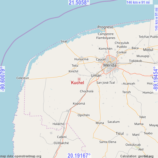
Kuchel GPS coordinates[2]
20° 51' 0.612" North, 89° 53' 51.576" West
| Map corner | latitude | longitude |
|---|---|---|
| Upper-left | 21.5058°, | -90.60079° |
| Center: | 20.85017°, | -89.89766° |
| Lower-right: | 20.19167°, | -89.19454° |
| Map W x H: | 146.1×146.1 km | = 90.8×90.8mi |
| max Lat: | 32.7° ⇑26% North |
| Kuchel: | 20.85017° |
| min Lat: | ⇓74% South 14.53588° |
| min Long | Kuchel | max Long |
| -117.105° | -89.89766° | -86.73105° |
| W 97.6%⇐ | ⇒2.4% E |
Elevation
Elevation of Kuchel is 10 m = 33 ft, and this is 1243.7 m = 4080 ft below average elevation for this country.
| Max E: |
3497 m = 11473 ft | 97% |
| Avg. | 1253.7 m = 4113 ft | |
| Kuchel | 10 m = 33 ft | |
Min E: |
-1 m = -3 ft | 3% |
See also: Mexico elevation on elevation.city.
Geographical zone
Kuchel is located in North Torrid zone (between Equator and Tropic of Cancer). Distance of this Northern Tropic circle is 287.6 km =178.7 mi to North.| Distance of | km | miles | from Kuchel |
|---|---|---|---|
| North Pole | 7688.7 | 4777.5 | to North |
| Arctic Circle | 5082.9 | 3158.4 | to North |
| Tropic Cancer | 287.6 | 178.7 | to North |
| Equator | 2318.3 | 1440.5 | to South |


Nearby cities:
15 places around Kuchel: (largest is in red/bold)
• Bolón
6.8 km =4.2 mi,  90°
90°
• Chochola
13.1 km =8.1 mi,  147°
147°
• Dzibikak
12 km =7.5 mi,  62°
62°
• Hunucmá
18.7 km =11.6 mi,  7°
7°
• Kinchil
8.9 km =5.5 mi,  323°
323°
• Nohuayun
15.7 km =9.8 mi,  332°
332°
• Oxcum
17.6 km =10.9 mi,  53°
53°
• Poxila
10.3 km =6.4 mi,  110°
110°
• Samahil
3.8 km =2.4 mi, 14°
• San Antonio Chum
5 km =3.1 mi, 52°
• San Antonio Tedzidz
8.3 km =5.2 mi,  258°
258°
• Tetiz
13.1 km =8.1 mi,  343°
343°
• Texan de Palomeque
11.8 km =7.3 mi,  34°
34°
• Uman
16.1 km =10 mi,  77°
77°
• Xtepen
16.3 km =10.1 mi,  100°
100°
Sources, notices
• [Note1] Compared only with cities in Mexico existing in our database
• [Src1] Map data: © OpenStreetMap contributors (CC-BY-SA)
• [Src2] Other city data from geonames.org with taken over terms of usage.
• [Src3] Geographical zone / Annual Mean Temperature by Robert A. Rohde @ Wikipedia
