Palmar geodata
Palmar (Quintana Roo) is a populated place; located in Mexico in America/Cancun (GMT-5) time zone. With population of 950 people, there are 9169 cities with bigger population in this country. Compared to other cities in Mexico, 73.2% of cities are located further ↑North; 99.2% of cities are located further ←West and 85.5% of cities have higher elevation than Palmar. Note1


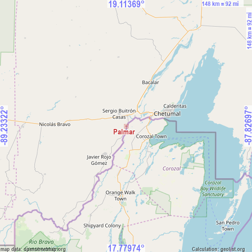
Palmar GPS coordinates[2]
18° 26' 52.836" North, 88° 31' 48.324" West
| Map corner | latitude | longitude |
|---|---|---|
| Upper-left | 19.11369°, | -89.23322° |
| Center: | 18.44801°, | -88.53009° |
| Lower-right: | 17.77974°, | -87.82697° |
| Map W x H: | 148.3×148.3 km | = 92.1×92.1mi |
| max Lat: | 32.7° ⇑73.2% North |
| Palmar: | 18.44801° |
| min Lat: | ⇓26.8% South 14.53588° |
| min Long | Palmar | max Long |
| -117.105° | -88.53009° | -86.73105° |
| W 99.2%⇐ | ⇒0.8% E |
Elevation
Elevation of Palmar is 41 m = 135 ft, and this is 1212.7 m = 3979 ft below average elevation for this country.
| Max E: |
3497 m = 11473 ft | 85.5% |
| Avg. | 1253.7 m = 4113 ft | |
| Palmar | 41 m = 135 ft | |
Min E: |
-1 m = -3 ft | 14.5% |
See also: Mexico elevation on elevation.city.
Geographical zone
Palmar is located in North Torrid zone (between Equator and Tropic of Cancer). Distance of this Northern Tropic circle is 554.7 km =344.7 mi to North.| Distance of | km | miles | from Palmar |
|---|---|---|---|
| North Pole | 7955.8 | 4943.5 | to North |
| Arctic Circle | 5349.9 | 3324.3 | to North |
| Tropic Cancer | 554.7 | 344.7 | to North |
| Equator | 2051.2 | 1274.6 | to South |


Nearby cities:
15 places around Palmar: (largest is in red/bold)
• Allende
7.6 km =4.7 mi,  200°
200°
• Carlos A. Madrazo
6 km =3.7 mi,  5°
5°
• Chetumal
25 km =15.5 mi,  72°
72°
• Huay-Pix
13.4 km =8.3 mi,  55°
55°
• Jesús González Ortega
15.3 km =9.5 mi,  286°
286°
• Juan Sarabia
7.9 km =4.9 mi,  42°
42°
• Nachi Cocom
23.6 km =14.7 mi,  279°
279°
• Ramonal
3.2 km =2 mi,  184°
184°
• Sabidos
11.8 km =7.3 mi,  210°
210°
• Sacxán
2.3 km =1.4 mi,  31°
31°
• Sergio Butrón Casas
8.4 km =5.2 mi,  330°
330°
• Subteniente López
15.6 km =9.7 mi, 70°
• Ucum
6.2 km =3.9 mi, 11°
• Xul-Ha
13.4 km =8.3 mi, 31°
• Álvaro Obregón
20.9 km =13 mi,  217°
217°
Sources, notices
• [Note1] Compared only with cities in Mexico existing in our database
• [Src1] Map data: © OpenStreetMap contributors (CC-BY-SA)
• [Src2] Other city data from geonames.org with taken over terms of usage.
• [Src3] Geographical zone / Annual Mean Temperature by Robert A. Rohde @ Wikipedia
