Ramonal geodata
Ramonal (Quintana Roo) is a populated place; located in Mexico in America/Cancun (GMT-5) time zone. With population of 901 people, there are 9681 cities with bigger population in this country. Compared to other cities in Mexico, 73.5% of cities are located further ↑North; 99.2% of cities are located further ←West and 92.5% of cities have higher elevation than Ramonal. Note1


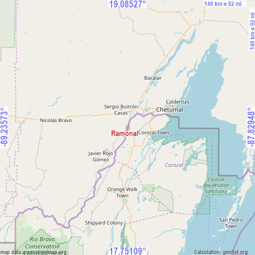
Ramonal GPS coordinates[2]
18° 25' 10.092" North, 88° 31' 57.36" West
| Map corner | latitude | longitude |
|---|---|---|
| Upper-left | 19.08527°, | -89.23573° |
| Center: | 18.41947°, | -88.5326° |
| Lower-right: | 17.75109°, | -87.82948° |
| Map W x H: | 148.3×148.3 km | = 92.1×92.1mi |
| max Lat: | 32.7° ⇑73.5% North |
| Ramonal: | 18.41947° |
| min Lat: | ⇓26.5% South 14.53588° |
| min Long | Ramonal | max Long |
| -117.105° | -88.5326° | -86.73105° |
| W 99.2%⇐ | ⇒0.8% E |
Elevation
Elevation of Ramonal is 18 m = 59 ft, and this is 1235.7 m = 4054 ft below average elevation for this country.
| Max E: |
3497 m = 11473 ft | 92.5% |
| Avg. | 1253.7 m = 4113 ft | |
| Ramonal | 18 m = 59 ft | |
Min E: |
-1 m = -3 ft | 7.5% |
See also: Mexico elevation on elevation.city.
Geographical zone
Ramonal is located in North Torrid zone (between Equator and Tropic of Cancer). Distance of this Northern Tropic circle is 557.9 km =346.7 mi to North.| Distance of | km | miles | from Ramonal |
|---|---|---|---|
| North Pole | 7959 | 4945.5 | to North |
| Arctic Circle | 5353.1 | 3326.3 | to North |
| Tropic Cancer | 557.9 | 346.7 | to North |
| Equator | 2048.1 | 1272.6 | to South |


Nearby cities:
15 places around Ramonal: (largest is in red/bold)
• Allende
4.6 km =2.9 mi,  211°
211°
• Carlos A. Madrazo
9.2 km =5.7 mi,  4°
4°
• Huay-Pix
15.6 km =9.7 mi,  46°
46°
• Javier Rojo Gómez
22.5 km =14 mi,  224°
224°
• Jesús González Ortega
16.3 km =10.1 mi,  297°
297°
• Juan Sarabia
10.6 km =6.6 mi,  31°
31°
• Palmar
3.2 km =2 mi, 4°
• Pedro Joaquín Coldwell
22.7 km =14.1 mi, 216°
• Sabidos
9 km =5.6 mi, 219°
• Sacxán
5.4 km =3.4 mi,  15°
15°
• Sergio Butrón Casas
11.2 km =7 mi,  340°
340°
• Subteniente López
17.1 km =10.6 mi,  60°
60°
• Ucum
9.4 km =5.8 mi,  9°
9°
• Xul-Ha
16.3 km =10.1 mi, 26°
• Álvaro Obregón
18.4 km =11.4 mi, 223°
Sources, notices
• [Note1] Compared only with cities in Mexico existing in our database
• [Src1] Map data: © OpenStreetMap contributors (CC-BY-SA)
• [Src2] Other city data from geonames.org with taken over terms of usage.
• [Src3] Geographical zone / Annual Mean Temperature by Robert A. Rohde @ Wikipedia
