Allende geodata
Allende (Quintana Roo) is a populated place; located in Mexico in America/Cancun (GMT-5) time zone. With population of 868 people, there are 10069 cities with bigger population in this country. Compared to other cities in Mexico, 74% of cities are located further ↑North; 99.2% of cities are located further ←West and 89.4% of cities have higher elevation than Allende. Note1


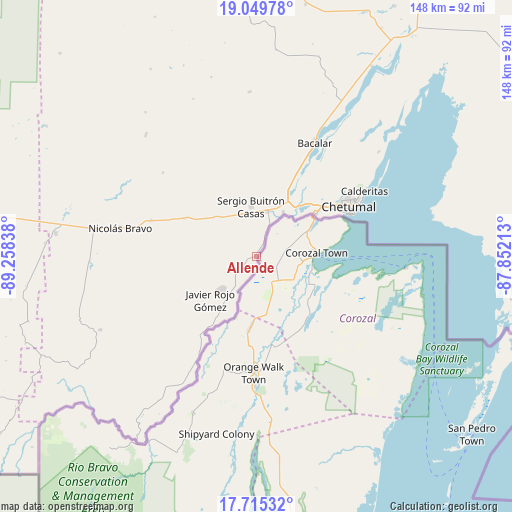
Allende GPS coordinates[2]
18° 23' 1.824" North, 88° 33' 18.9" West
| Map corner | latitude | longitude |
|---|---|---|
| Upper-left | 19.04978°, | -89.25838° |
| Center: | 18.38384°, | -88.55525° |
| Lower-right: | 17.71532°, | -87.85213° |
| Map W x H: | 148.4×148.4 km | = 92.2×92.2mi |
| max Lat: | 32.7° ⇑74% North |
| Allende: | 18.38384° |
| min Lat: | ⇓26% South 14.53588° |
| min Long | Allende | max Long |
| -117.105° | -88.55525° | -86.73105° |
| W 99.2%⇐ | ⇒0.8% E |
Elevation
Elevation of Allende is 26 m = 85 ft, and this is 1227.7 m = 4028 ft below average elevation for this country.
| Max E: |
3497 m = 11473 ft | 89.4% |
| Avg. | 1253.7 m = 4113 ft | |
| Allende | 26 m = 85 ft | |
Min E: |
-1 m = -3 ft | 10.6% |
See also: Mexico elevation on elevation.city.
Geographical zone
Allende is located in North Torrid zone (between Equator and Tropic of Cancer). Distance of this Northern Tropic circle is 561.8 km =349.1 mi to North.| Distance of | km | miles | from Allende |
|---|---|---|---|
| North Pole | 7963 | 4948 | to North |
| Arctic Circle | 5357.1 | 3328.7 | to North |
| Tropic Cancer | 561.8 | 349.1 | to North |
| Equator | 2044.1 | 1270.1 | to South |


Nearby cities:
15 places around Allende: (largest is in red/bold)
• Carlos A. Madrazo
13.5 km =8.4 mi,  13°
13°
• Huay-Pix
20.1 km =12.5 mi,  42°
42°
• Javier Rojo Gómez
18.1 km =11.2 mi,  227°
227°
• Jesús González Ortega
16.7 km =10.4 mi,  313°
313°
• Juan Sarabia
15.2 km =9.4 mi,  31°
31°
• Palmar
7.6 km =4.7 mi,  20°
20°
• Pedro Joaquín Coldwell
18.1 km =11.2 mi,  218°
218°
• Pucté
20.6 km =12.8 mi, 215°
• Ramonal
4.6 km =2.9 mi, 31°
• Sabidos
4.5 km =2.8 mi, 228°
• Sacxán
9.9 km =6.2 mi, 22°
• Sergio Butrón Casas
14.5 km =9 mi,  354°
354°
• Ucum
13.8 km =8.6 mi, 16°
• Xul-Ha
21 km =13 mi, 27°
• Álvaro Obregón
13.9 km =8.6 mi, 227°
Sources, notices
• [Note1] Compared only with cities in Mexico existing in our database
• [Src1] Map data: © OpenStreetMap contributors (CC-BY-SA)
• [Src2] Other city data from geonames.org with taken over terms of usage.
• [Src3] Geographical zone / Annual Mean Temperature by Robert A. Rohde @ Wikipedia
